Embarking on the Gokyo Cho La Pass Trekking via EBC is a true adventure for trekking enthusiasts. This remarkable journey takes you through breathtaking landscapes, pristine lakes, and High Mountain passes. To guarantee a secure and pleasant trek, it is crucial to have a comprehensive understanding of the route, landmarks, and altitudes. In this blog, we will explore the Gokyo Cho La Pass Trekking via EBC Map and Altitude Chart Map, providing valuable insights to help you navigate this extraordinary adventure.
Exploring the Gokyo Cho La Pass Trekking via EBC Map

Role of a Trek Map
When embarking on the Gokyo Cho La Pass Trekking via EBC, a comprehensive trek map is an essential tool for ensuring a safe and successful trekking experience. Let's delve into the importance of a map and how it provides crucial information about the route, distances, and landmarks.
- Ensuring Safety and Navigation
A trekking map serves as a reliable guide, helping trekkers navigate through the challenging terrains of the Gokyo Cho La Pass Trekking via EBC. It provides valuable information about the trail, ensuring that trekkers stay on the designated route and avoid potential hazards. By following the map, trekkers can make informed decisions, stay on track, and minimize the risk of getting lost.
- Distances and Time Management
The Gokyo Cho La Pass Trekking via EBC Map offers valuable insights into distances between key locations. By referring to the map, trekkers can estimate the length of each day's hike and plan their schedule accordingly. This knowledge helps in managing time and resources effectively, ensuring that trekkers have enough time to complete each leg of the journey comfortably. It also assists in coordinating rest stops and overnight stays, allowing for a well-paced and enjoyable trekking experience.
- Identifying Landmarks and Points of Interest
A trekking map provides trekkers with valuable information about significant landmarks and points of interest along the Gokyo Cho La Pass Trekking via EBC. It marks iconic sites like Namche Bazaar, Tengboche Monastery, Gokyo Lakes, and, of course, Everest Base Camp itself. These landmarks hold cultural, historical, and natural significance, adding depth and richness to the overall trekking experience. By referencing the map, trekkers can plan their visits to these sites, ensuring they don't miss out on the highlights of the journey.
Gokyo Cho La Pass Trekking via EBC Route Map
The Gokyo Cho La Pass Trekking via EBC Route Map serves as an invaluable visual guide, providing trekkers with essential information about the journey ahead. Let's explore the features of this comprehensive map, including trails, topography, and key landmarks along the route.
- Trails and Route
The Gokyo Cho La Pass Trekking via EBC Route Map outlines the trekking trail from Lukla to Gokyo via Everest Base Camp and crossing the challenging Cho La Pass. It highlights the main trails and alternative routes, ensuring trekkers have a clear understanding of the path they need to follow. By referencing the map, trekkers can stay on track, explore detours if desired, and make informed decisions about their journey.
- Topography and Landscapes
One of the notable features of the Gokyo Cho La Pass Trekking via EBC Route Map is its depiction of the topography and landscapes along the route. It showcases the majestic Himalayan peaks, deep valleys, glacial lakes, and High Mountain passes that trekkers will encounter. This visual representation provides a glimpse into the awe-inspiring beauty of the surroundings, allowing trekkers to mentally prepare for the diverse terrains they will traverse.
- Key Landmarks and Villages
The Gokyo Cho La Pass Trekking via EBC Route Map highlights key landmarks and villages along the route, offering insight into the cultural, historical, and natural significance of each location. It marks iconic sites such as Namche Bazaar, Tengboche Monastery, Gokyo Lakes, and Everest Base Camp itself. These landmarks act as important waypoints, guiding trekkers and adding depth to their overall trekking experience. By referencing the map, trekkers can plan their visits to these landmarks, ensuring they don't miss out on the highlights of the journey.
- Rest Stops and Acclimatization Points
Another valuable feature of the Gokyo Cho La Pass Trekking via EBC Route Map is its indication of rest stops and acclimatization points along the route. These designated locations provide trekkers with opportunities to rest, acclimatize to the increasing altitude, and adjust their pace accordingly. By referring to the map, trekkers can plan their itinerary, estimate distances between each rest stop, and ensure they allocate sufficient time for acclimatization. This aids in the prevention of altitude sickness and promotes a safe and enjoyable trekking experience.
Navigating the Gokyo Cho La Pass Trekking via EBC Altitude Map

Understanding Altitude and Acclimatization in Gokyo Cho La Pass Trekking via EBC
Altitude plays a significant role in the Gokyo Cho La Pass Trekking via EBC, a challenging and awe-inspiring adventure in the Everest region. During this incredible adventure, it is necessary to comprehend how high altitude affects the body and how important acclimatization is. Let's explore the significance of altitude and the challenges of acclimatization, emphasizing the need for a gradual ascent.
- Significance of Altitude
In the Gokyo Cho La Pass Trekking via EBC, trekkers venture into high altitudes where the air becomes thinner, and oxygen levels decrease. The reduced oxygen availability at higher elevations can pose challenges to the human body. Trekkers must be aware of the effects of altitude in order to psychologically and physically prepare for the adventure ahead.
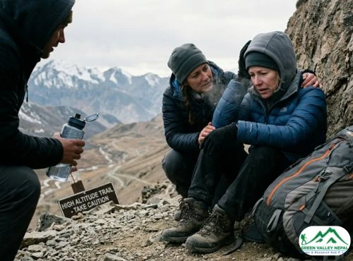
- Challenges of Acclimatization
The process of acclimatization is how the body adjusts to the lower oxygen levels and changes altitude. The body adjusts gradually to the low-oxygen environment in order to perform at its best. Proper acclimatization is essential to prevent altitude sickness and ensure a safe and enjoyable trekking experience in the Gokyo Cho La Pass Trekking via EBC.
- Need for a Gradual Ascent
A gradual ascent is key to successful acclimatization in the Gokyo Cho La Pass Trekking via EBC. Rushing the trek or ascending too quickly significantly increases the risk of altitude-related illnesses. Following a well-planned schedule that incorporates rest days and acclimatization breaks can help you give your body enough time to adapt to the new altitude.
Gokyo Cho La Pass Trekking via EBC Altitude Chart Map
- Purpose and Benefits
The Gokyo Cho La Pass Trekking via EBC Altitude Chart Map is a valuable tool that provides a visual representation of the altitude gain throughout the trek. It highlights the elevations at various points along the route, aiding trekkers in understanding the altitude profile of the journey. This map serves as a reference guide, offering valuable insights into the ascent and facilitating proper acclimatization planning.
- Visualization of Altitude Gain
The Gokyo Cho La Pass Trekking via EBC Altitude Chart Map visually represents the gradual increase in altitude from the starting point in Lukla to the challenging Cho La Pass and finally to Everest Base Camp. By studying the altitude chart, trekkers can visualize the steepness and intensity of each section of the trek. This visualization helps trekkers understand the difficulty levels and prepare mentally for the journey ahead.
- Key Acclimatization Stops
The Gokyo Cho La Pass Trekking via EBC Altitude Chart Map indicates key acclimatization stops along the route, such as Namche Bazaar, Dingboche, and Lobuche. These designated rest days provide trekkers with an opportunity to adjust to the increasing altitude, allowing their bodies to acclimatize gradually. By referring to the altitude chart, trekkers can plan their itinerary, ensuring they allocate sufficient time for acclimatization at these crucial points.
Essential Locations of the Gokyo Cho La Pass Trekking via EBC
- Lukla (2,860m)
Lukla serves as the starting point of the Gokyo Cho La Pass Trekking via EBC. This little hamlet is known for its exhilarating mountain airstrip and is tucked away in the middle of the Khumbu area. As trekkers set foot in Lukla, they are immediately captivated by the stunning mountain vistas that surround the area. Lukla also acts as a gateway to the Everest region, providing a unique blend of natural beauty and vibrant Sherpa culture.
- Namche Bazaar (3,440m)
Namche Bazaar is a bustling Sherpa town that holds a significant role in the Gokyo Cho La Pass Trekking via EBC. It is a crucial acclimatization break on the climb and is situated at an elevation of 3,440 m. Namche Bazaar offers a wealth of amenities, including cozy lodges, shops, bakeries, and cafes. Trekkers can immerse themselves in the vibrant local culture, explore the bustling market, and enjoy breathtaking views of Everest and neighboring peaks.
- Tengboche (3,860m)
One of the most important spiritual junctions in the Khumbu region, Tengboche is home to the famous Tengboche Monastery. Nestled amidst picturesque landscapes, this monastery holds immense cultural significance for the Sherpa community. Trekkers have the opportunity to witness daily prayer ceremonies and soak in the serene atmosphere. The panoramic views of Everest, Ama Dablam, and other Himalayan peaks from Tengboche create an unforgettable experience.
- Dingboche (4,410m)
Dingboche is a picturesque village nestled in a beautiful valley. It offers stunning landscapes adorned with terraced fields and stone-walled houses. At an elevation of 4,410m, Dingboche serves as a vital acclimatization point on the trek. Trekkers can explore the surrounding hills, visit the local bakery, and enjoy breathtaking views of towering peaks such as Lhotse, Nuptse, and Makalu.
- Lobuche (4,940m)
Located at 4,940m, Lobuche is a significant location on the Gokyo Cho La Pass Trekking via EBC. It is renowned for its challenging terrain and rugged beauty. Trekkers will find themselves surrounded by stunning glaciers and panoramic mountain views. Lobuche also serves as a base camp for climbers embarking on expeditions to Everest and other prominent peaks in the region.
- Everest Base Camp (5,364m)
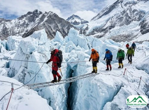
Reaching Everest Base Camp is the ultimate goal of the Gokyo Cho La Pass Trekking via EBC. At 5,364 meters above sea level, it gives hikers a sense of accomplishment and incredible views of Mount Everest. Standing amidst the Khumbu Icefall, surrounded by the towering Himalayan giants, trekkers can soak in the atmosphere of this iconic location and appreciate the immense beauty that surrounds them.
- Kala Patthar (5,545m)
Kala Patthar, meaning "Black Rock," is a famous viewpoint located at an elevation of 5,545m. Trekkers often make the ascent to this vantage point to witness the awe-inspiring sunrise over Everest. From Kala Patthar, the panoramic views of Everest, Nuptse, Lhotse, and other surrounding peaks are simply breathtaking. This is a cherished moment for trekkers, offering an unforgettable memory of the Everest region.
- Dzongla (4,830m)
Dzongla is a picturesque village situated at an elevation of 4,830m. It offers trekkers a unique perspective of the surrounding natural beauty. Dzongla is a peaceful resting place along the trail that offers stunning views of glaciers, snow-capped peaks, and unspoiled landscapes, letting trekkers enjoy the peace of the Himalayas.
- Cho La Pass (5,420m)
The challenging Cho La Pass is a significant highlight of the Gokyo Cho La Pass Trekking via EBC. At an altitude of 5,420m, crossing this pass requires stamina and determination. However, the stunning mountain vistas and the sense of accomplishment upon reaching the pass make it a memorable experience. Trekkers are rewarded with panoramic views of Everest, Ama Dablam, and other surrounding peaks as they traverse this dramatic mountain pass.
- Gokyo Lakes (4,750m)
The Gokyo Lakes are a series of stunning turquoise lakes situated at an altitude of 4,750m. Trekkers are mesmerized by the beauty of these sacred lakes and their reflection of the surrounding Himalayan peaks. The tranquil ambiance and awe-inspiring landscapes make the Gokyo Lakes a treasured location along the trek.
- Gokyo Ri (5,357m)
Gokyo Ri is a popular vantage point situated at an elevation of 5,357m. From the summit of Gokyo Ri, trekkers are rewarded with panoramic views of Everest, Cho Oyu, Makalu, and several other prominent peaks. The sunrise view from Gokyo Ri is particularly breathtaking, creating a truly magical experience.
- Dhole (4,200m)
Dhole is a small village located at an altitude of 4,200m. It offers trekkers a serene setting amidst the mountains, with stunning views of the surrounding landscapes. Dhole serves as a peaceful stop along the trek, allowing trekkers to relax, recharge, and appreciate the natural beauty of the Himalayas.
These essential locations along the 16-day Gokyo Cho La Pass Trekking via EBC each have their own unique characteristics, adding depth and richness to the overall trekking experience. From the starting point in Lukla to reaching Everest Base Camp, trekkers are immersed in the awe-inspiring landscapes, vibrant Sherpa culture, and breathtaking mountain views that define the Everest region.
Conclusion
With the detailed insights provided by the Gokyo Cho La Pass Trekking via EBC Map and Altitude Chart Map, you are well-equipped to embark on this extraordinary journey. Plan your route, understand the altitudes, and make the most of the essential locations along the 16-day trek. Remember to prioritize safety and acclimatization, and immerse yourself in the breathtaking beauty of the Gokyo Cho La Pass Trekking via EBC.