What Happened in Rasuwa? A Quick Timeline
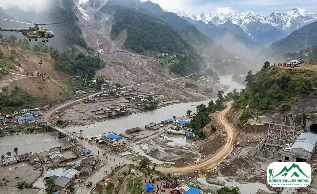
At around 8:30–9:00 AM on Wednesday, August 26, 2026, a massive surge of water, ice, and rock came down from the Tibetan side of the Nepal-China border into the Bhote Koshi River in Rasuwa district. According to Al Jazeera's reporting, the initial surge entered the Lhende Khola in Tibet, which feeds into the Bhote Koshi and then the Trishuli River, before carrying floodwaters south through Nepal.
Within roughly an hour, the flood had reached Timure, Syabrubesi, Betrawati, and Trishuli Bazar. Water levels on the Trishuli River reportedly rose by as much as 9 metres in just 30 minutes, per Al Jazeera. The surge continued downstream through Nuwakot, Dhading, Gorkha, Tanahun, Nawalparasi, and reached as far as Chitwan, according to live tracking of the disaster. Kathmandu Valley itself was not flooded, and Tribhuvan International Airport has continued operating normally throughout, per the U.S. Embassy in Nepal.
Rasuwa Flood Death Toll and Missing
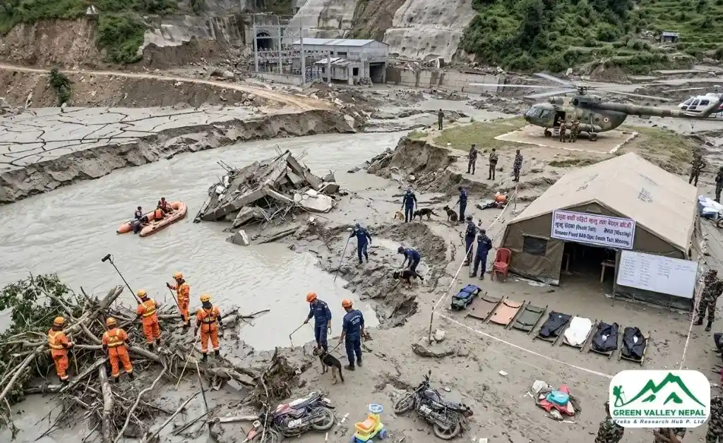
This is the number that has changed the most since our last update, and it is still moving. In its morning bulletin of August 31, Nepal's disaster authority put the confirmed death toll at more than 900 in Nepal, with around 4,247 people listed as missing, more than 590 of them foreign nationals, according to BBC's coverage. A separate 16 deaths have been confirmed on the Tibetan side of the border. Because wire services update on different schedules, you will also see lower figures still in circulation; NBC News reported 734 dead and roughly 2,500 missing on August 29, for example. Treat any single number as a snapshot rather than a final count.
Two things are worth understanding about the missing figure specifically. First, it climbed sharply between August 29 and 31 largely because registration is catching up with the disaster, not because a new wave of casualties occurred; families are still filing reports at district centers as access improves.
Second, industry sources tracking the situation note that “out of contact” does not automatically mean a person has died: many lodges and villages in the Langtang and Rasuwa region run on minimal power and patchy signal even in normal conditions, and the collapse of local telecom towers has simply made a large number of people temporarily unreachable rather than confirmed victims.
For the current official count, check Nepal Police and NDRRMA bulletins directly, or follow live coverage from CNN, Al Jazeera, or the continuously updated Wikipedia timeline of the disaster.
What Caused the Rasuwa Flash Flood?
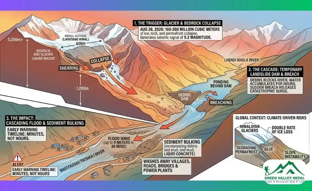
The short version: a section of glacier collapsed at high altitude and fell into the Lhende Khola in Tibet, about 20 km upstream of the Miteri Bridge, forming a temporary debris-dammed lake that then burst and sent the flood wave south into Nepal. Nepal's Department of Hydrology and Meteorology and independent glaciologists working with satellite imagery through ICIMOD back this as the leading explanation.
There was early confusion because the collapse registered as a seismic event. The U.S. Geological Survey's initial reading logged a much smaller signal, but after reviewing long-period seismic waves and satellite imagery, it revised the assessment upward; some later estimates put the signal at roughly magnitude 5.2, and reclassified it as a glacial collapse rather than tectonic activity, as reported by The Print. Rasuwa's Chief District Officer also confirmed there was no rainfall recorded at the district headquarters when the flood struck, ruling out monsoon rain as the trigger and pointing firmly to the upstream glacial event.
One scientific detail underlines just how violent this was: physicist Jeffrey Kargel of the Planetary Science Institute told CNN that the flood wave covered its first 22 kilometers at an average speed of about 193 km/h, nearly 14 miles in under seven minutes, which explains why warning time in Timure and Syabrubesi was measured in minutes, not hours.
Has This Happened Before in Rasuwa?
Yes. A similar flood hit the same Bhote Koshi corridor on July 8, 2025, just over a year before this disaster, also destroying the Miteri (Friendship) Bridge connecting Nepal and China. Recovery from that smaller event took time: one-way traffic on the Syabrubesi–Rasuwagadhi road resumed after 13 days, and a permanent replacement bridge wasn't installed until December 2025. The recurrence within just over a year has intensified scientific concern about the stability of glacial lakes feeding the Lhende and Bhote Koshi rivers, and it's the main reason we are being cautious about predicting a reopening date for this considerably larger event below.
Rasuwa Flood Map: Where Did the Water Travel?
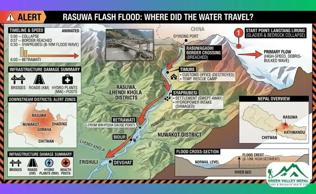
Understanding the geography helps explain why the damage spread so far, so fast:
- Origin point: a glacier collapse roughly 20 km upstream of the Rasuwagadhi border crossing, in Tibet's Gyirong (Kyirong) County
- Lhende Khola (Tibet): the initial debris avalanche struck here first
- Bhote Koshi River: the Lhende feeds into the Bhote Koshi, which crosses into Rasuwa district at the Rasuwagadhi–Gyirong border point
- Timure and Syabrubesi: the first major Nepali settlements hit, within roughly an hour of the collapse
- Betrawati and Trishuli Bazar: downstream along the Trishuli River, these areas saw water rise dramatically within 30 minutes
- Nuwakot, Dhading, Gorkha, Tanahun, Nawalparasi, and Chitwan: flooding and recovered remains have been reported as far downstream as Narayanghat and the Narayani River, per the ongoing damage assessment
On the Chinese side, mud and debris also struck Gyirong Port in the Shigatse region, per Al Jazeera.
Is Dhunche Affected? What about Syabrubesi, Timure, and Betrawati?
- Syabrubesi: Directly and severely affected. It sits along the Bhote Koshi corridor and took heavy damage, including in Ward No. 5.
- Dhunche: Less directly exposed. Dhunche sits higher above the river and short of the worst-hit stretch of the corridor, though it still depends on the same damaged Pasang Lhamu Highway for vehicle access from Kathmandu.
- Timure: Among the worst-hit settlements, sitting closest to the border crossing where the flood first entered Nepal, the Timure Customs Office and the Miteri Bridge to China were both destroyed.
- Betrawati: This settlement downstream, on the Trishuli, was also swept through by floodwaters and remains part of the damaged road corridor.
Is the Langtang Trek Route Safe? A Trek-by-Trek Breakdown
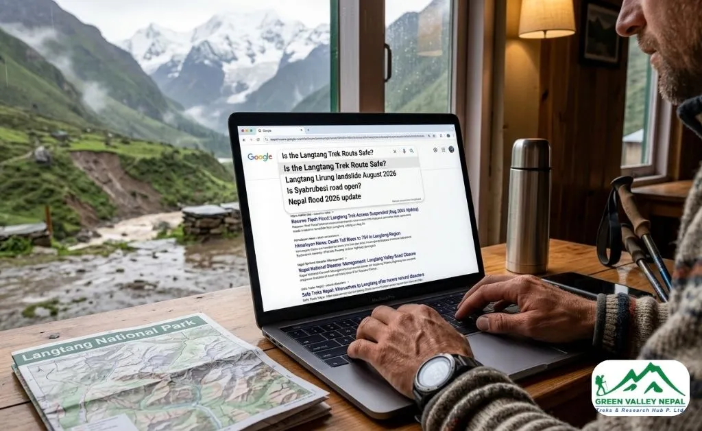
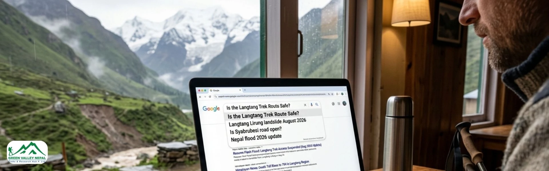
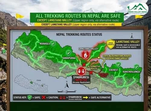
Yes, Langtang Valley and the Gosaikunda lakes both lie within Rasuwa district, and this is the single most-asked question we are getting from clients right now. The reassuring part: the Langtang trail itself, in the upper valley toward Kyanjin Gompa, sits in a different river drainage from the Bhote Koshi that flooded, so the trekking route has not been physically damaged by this event. The real issue is getting to the trailhead, since Syabrubesi, the standard road-head for most routes in this region, sits directly in the flood-hit corridor. Here's how that plays out for each of our itineraries in the region:
- Langtang Valley Trek – 10 Days: Trail unaffected; road access via Syabrubesi is currently restricted. This is the itinerary most directly tied to the road closure, confirm departure dates with us before booking flights.
- Langtang Gosaikunda Lake Trek – 15 Days: Same situation as above for the Langtang portion of this combined route; the Gosaikunda side benefits from the Dhunche access option described below.
- Gosaikunda Lake Trek – 7 Days: Somewhat more resilient. This route typically leaves the road at Dhunche rather than Syabrubesi, which sits on the less-exposed side of the damaged corridor, though it still relies on the same highway from Kathmandu.
- Tamang Heritage Trail Trek – 10 Days: More exposed than the main Langtang Valley route, since several of its villages sit closer to Timure and the northern part of the affected corridor. We are assessing village-by-village before confirming departures.
- Langtang Ganja La Pass Trek – 14 Days: Also road-dependent via Syabrubesi, with the added complexity of a high, remote pass, we are being conservative with this one until the access road and upper trail conditions are both confirmed.
- Helambu Circuit Trek – 8 Days: Not affected. This route runs via Sundarijal and Melamchi in a separate valley system to the east, entirely outside the Bhote Koshi/Trishuli flood corridor.
- Ama Yangri Trek – 3 Days: Not affected. Like the Helambu Circuit, this short trek is accessed via Melamchi and Tarkeghyang in Sindhupalchok, well clear of the flood zone, a good option if you wanted a quick Kathmandu-region trek this week.
For anyone with a Langtang-region trek booked, the honest picture right now is: the mountains are fine, but the road connecting Kathmandu to Rasuwa needs to reopen first. If your dates are flexible, browse our full range of treks; we can move you onto the Helambu Circuit or Ama Yangri Trek with no change in region, or shift your Langtang departure to align with the recovery timeline below.
Kathmandu to Rasuwa Road Status
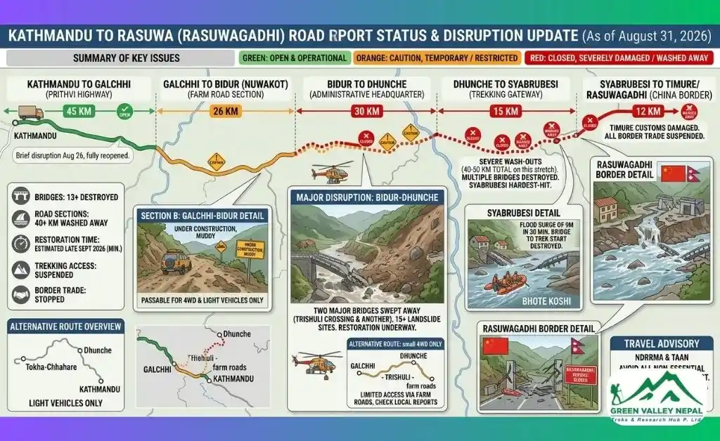
Rasuwa is normally reached from Kathmandu via the Pasang Lhamu Highway, running north through Betrawati and Dhunche toward Syabrubesi and the Rasuwagadhi border. As of August 31, this remains restricted: the U.S. Embassy in Nepal reports that all highways in Rasuwa and Nuwakot districts are blocked, the Trishuli–Mailung–Syafrubesi road is blocked, and multiple sections of the Prithvi Highway in Dhading are also closed, cutting off the normal overland route from Kathmandu toward Langtang. Nepal's Department of Roads has said a roughly 42-km stretch between Betrawati and the Rasuwagadhi border was damaged or washed away, with several bridges destroyed.
We are deliberately not promising a reopening date. After the comparable, but considerably smaller, July 2025 flood on this same road, one-way traffic took 13 days to resume, and a permanent bridge replacement took months. This event damaged roughly two-and-a-half times as much road, took out more bridges, and struck during an active monsoon, so a longer restoration window is realistic. We're tracking the Department of Roads' updates daily and will revise our own departure schedule the moment light-vehicle access resumes.
What about the Overland Tibet / Kailash Route?
The Rasuwagadhi–Gyirong border crossing, the main overland gateway used for Kailash Mansarovar trips, was severely damaged and is considered closed for this season. The Miteri Bridge connecting the two countries was destroyed, and Chinese authorities have separately paused rescue work on their side while assessing an unstable upstream lake. If you have a Kailash trip planned via this route, expect it to shift to a Kathmandu–Lhasa fly-in alternative rather than the overland crossing.
Rasuwa and Sindhupalchok
Rasuwa's neighbouring district, Sindhupalchok, has faced comparable glacial and flash-flood disasters in the past, and both sit within the same high-risk Himalayan belt that ICIMOD has repeatedly flagged for glacial lake hazards. It's worth being precise here, though: this flood was centred on the Bhote Koshi corridor in western Rasuwa. The Helambu and Ama Yangri routes, while technically reaching into Sindhupalchok district too, sit in the separate Melamchi valley to the east and were not exposed to this particular event, which is why we are comfortable continuing to run them without changes.
Rescue Operations and Government Response
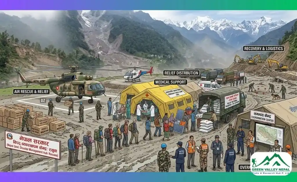
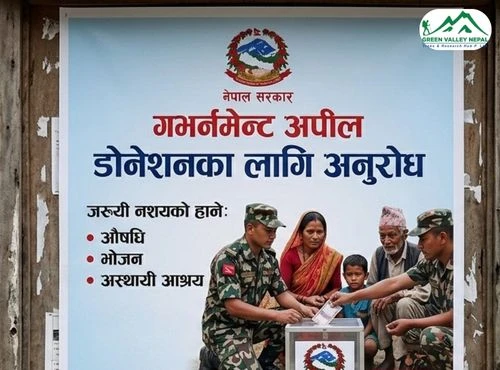
The Nepali Army, Nepal Police, and Armed Police Force have led rescue operations from the outset, with helicopters flying continuous missions out of Tribhuvan International Airport into the flood zone. Survivors airlifted from the disaster area have been brought to Maithali Barrack, an army training centre in Trishuli, Nuwakot district, according to CNN's on-the-ground coverage. At least 466 people have been confirmed injured. Humanitarian partners including CARE are now running emergency response programmes for displaced families, including one community of roughly 250 households in Rasuwa, originally resettled there after the 2015 earthquake that has reportedly been swept away entirely.
Ongoing Risk: Is Another Flood Possible?
This is not a closed chapter. Nepali and Chinese authorities are actively monitoring newly formed debris-dammed lakes upstream, and China has separately warned of a “high risk” lake near the border that could trigger fresh flooding if it bursts. Nepal's Department of Hydrology and Meteorology says it has no current indication of another major destructive flood, but continuing monsoon rainfall could still raise river levels and trigger further local flooding, landslides, or road damage. We are continuing to advise clients and staff to stay away from riverbanks and low-lying areas in Rasuwa and Nuwakot until this is fully resolved.
What do we want to tell Our Clients at Green Valley Nepal Treks?
- If you have a Langtang, Gosaikunda, Tamang Heritage, or Ganja La departure booked in the next two weeks, we will contact you directly with options: postponement, a route swap onto Helambu or Ama Yangri, or a delayed start date once the road reopens.
- If your departure is in October or November: no action needed yet. We are monitoring the Department of Roads updates and will only flag a change if restoration is running noticeably behind the historical 13-day-plus pattern.
- If you are deciding what to book this week: the Helambu Circuit Trek and Ama Yangri Trek are both running as normal, with views of the same Langtang Himal range from a different, unaffected valley.
- Don't rely on a pre-flood map, blog post, or video to judge current conditions. Mountain roads and trails can change completely after an event like this; always confirm directly with a registered operator before departure.
Get in touch through our website, and we will walk you through the current status of your specific itinerary.
Frequently Asked Questions (FAQs)
- Is the Langtang trek route safe right now?
The trail itself is undamaged, but road access to the Syabrubesi trailhead is currently restricted. Check with a registered operator like Green Valley Nepal Treks before departure.
- Is the Gosaikunda trek affected by the flood?
Partially. The Gosaikunda Lake Trek accesses via Dhunche, which sits on the less-exposed side of the damaged corridor, though it still depends on the same highway from Kathmandu.
- Are Helambu and Ama Yangri treks safe?
Yes. Both the Helambu Circuit and Ama Yangri Trek access via Sundarijal and Melamchi, a separate valley entirely outside the flood corridor, and are running as normal.
- When will the Kathmandu–Syabrubesi road reopen?
No confirmed date yet. A comparable but smaller flood on this road in July 2025 took 13 days to reopen to one-way traffic; this event caused significantly more damage, so a longer timeline is realistic.
- What is the current death toll from the Rasuwa flood?
As of the August 31 morning bulletin, more than 900 people are confirmed dead in Nepal, and around 4,247 remain listed as missing, though figures are still being verified and “missing” includes many people who are simply unreachable due to damaged phone networks, not necessarily deceased.