Mera Peak Expedition Distance Overview
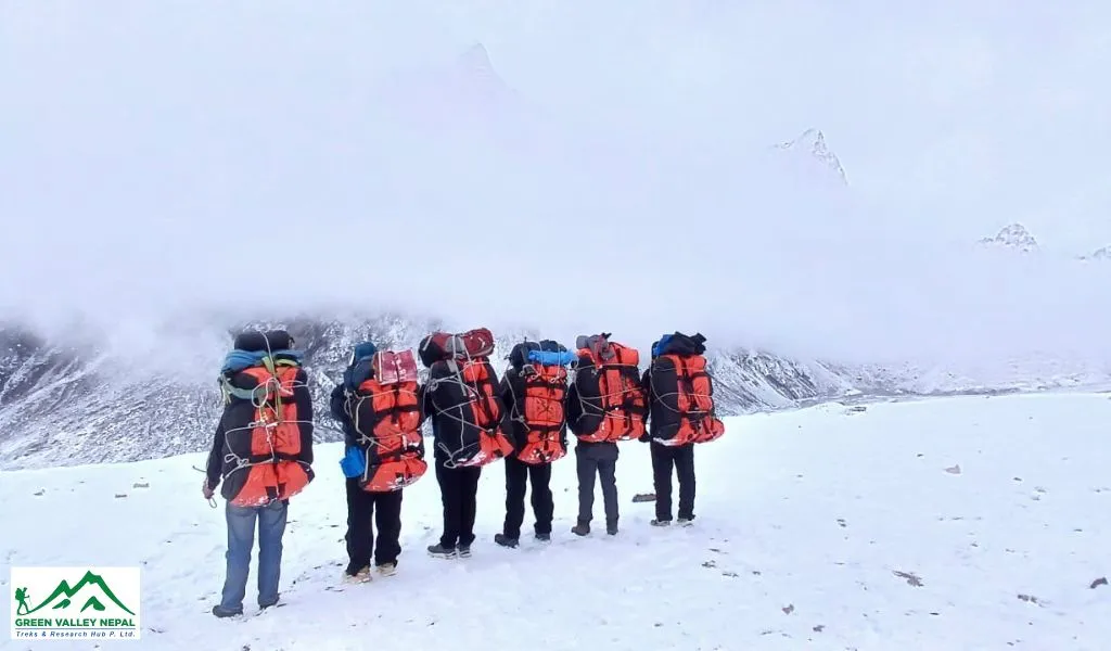
Setting out on the Mera Peak Expedition is open to anyone who has some basic physical training to suit trekking and mountaineering. With an elevation of 6461m (21197 ft.), Mera Peak is the highest trekking peak in the world. The peak lies within the Makalu-Barun National Park in the Hinku Valley, surrounded by jungle and sub-alpine and alpine forests. Typically, the expedition to Mera Peak spans 14 to 16 days, which gives a top-notch experience in the High Himalayas.
Our well-executed Mera Peak expedition itinerary commences at Lukla Gateways and continues to Paiya, Pangoma, Nagindingma, Khola Kharka, Kothe, Tanknak, and Mera High Base Camp, then ascends to the summit via the Khare route and returns to Lukla. Day 10 is a painful climb on a rough road to Mera summit; each step toward the summit will test your stamina.
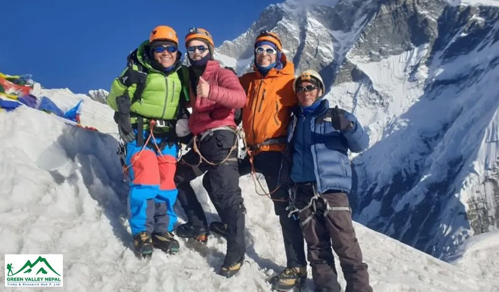
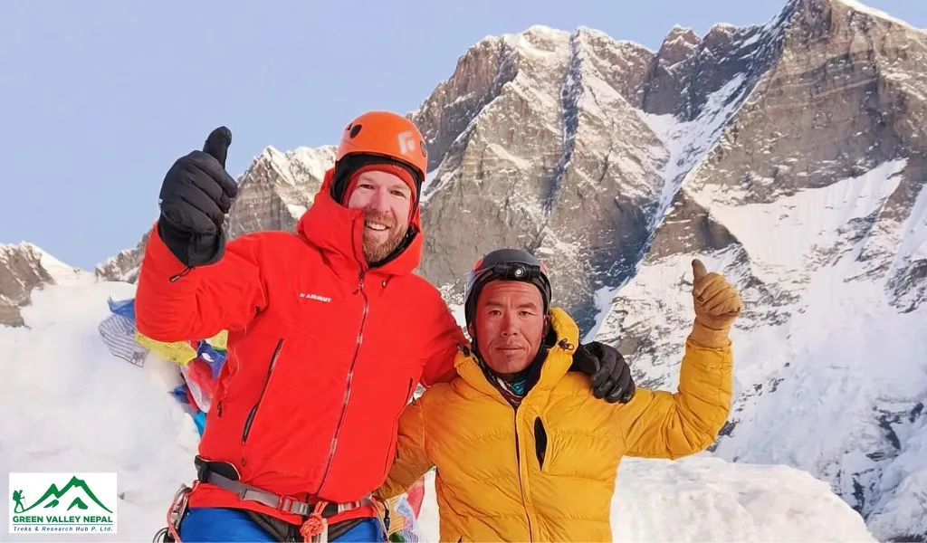
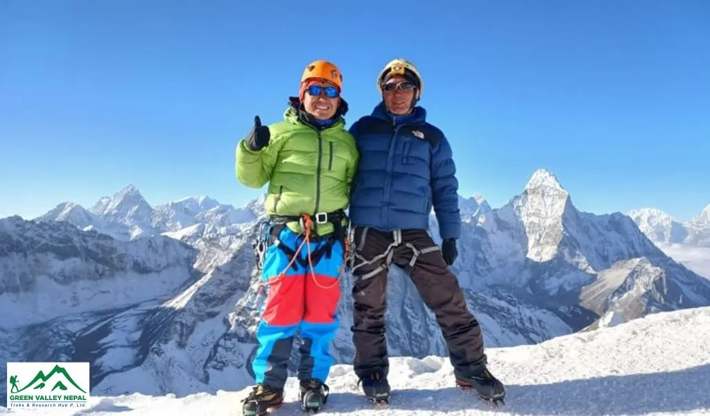
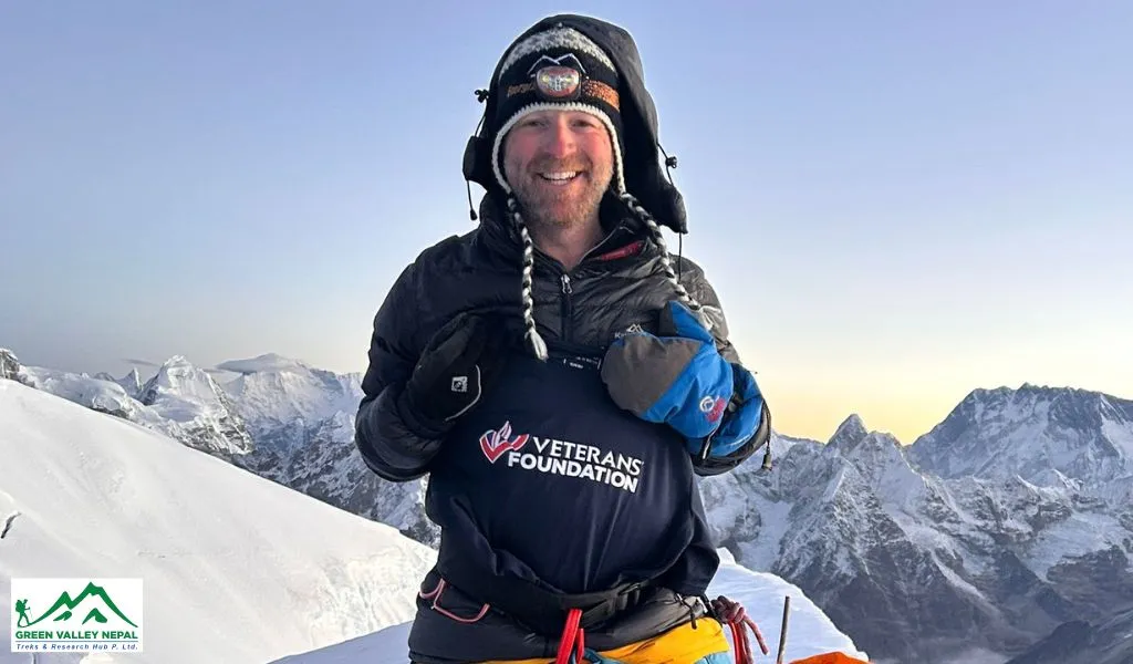
From the Mera Summit, remarkable views of Everest, Lhotse, Cho Oyu, Makalu, and Kangchenjunga are phenomenal. Indeed, the panorama from Mera Peak is widely regarded as presenting the best views of these five spectacular 8000m (26246 ft.) giant peaks. With the summit so close yet so far, the journey teeters on a pivotal moment.
Although it is considered a relatively straightforward and non-technical climb, the physical challenges are tough here, which demands great fitness. An adequate physical training regimen and strong motivation are essential to succeed in the Summit.
The full climbing distance on the standard route is approximately 111 KM (69 Miles), but the distance may vary depending on the itinerary you favor. If you are eager to learn more about the distance of the Mera Peak Expedition, keep following our blogs for more updates.
Mera Peak Expedition Distance Breakdown and Altitude Coverage
Trekking Trail | Distance | Duration | Altitude |
Lukla to Paiya | 9.5 km (5.9 miles) | 5 to 6 Hours | 2730 m. (8957 ft.) |
Paiya to Pangoma | 11 km (6.8 miles) | 5 to 6 Hours | 2846 m. (9337 ft.) |
Pangoma to Nagindingma | 7.2 km (4.5 miles) | 5 to 6 Hours | 2650 m. (8694 ft.) |
Nagindingma to Khola Kharka | 12 km (7.5 miles) | 6 to 7 Hours | 3930 m. (12894 ft.) |
Khola Kharka to Kothe | 13 km (8.1 miles) | 6 to 7 Hours | 3691 m. (12110 ft.) |
Kothe to Thaknak | 8.3 km (5.2 miles) | 3 to 4 Hours | 4358 m. (14298 ft.) |
Thaknak to Khare | 3.3 km (2.1 miles) | 4 to 5 Hours | 5045 m. (16552 ft.) |
Khare to Mera High Camp | 4.6 km (2.9 miles) | 6 to 7 Hours | 5780 m. (18963 ft.) |
Mera High Camp to Mera Summit | 4 km (2.5 miles) | 7 to 8 Hours | 6461 m. (21198 ft.) |
Mera High Camp to Khare | 3 km (1.9 miles) | 2 to 3 Hours | 5045 m. (16552 ft.) |
Khare to Kothe | 13.5 km (8.4 miles) | 6 to 7 Hours | 3600 m. (11811 ft.) |
Kothe to Chetarwa | 6.5 km (4.1 miles) | 6 to 7 Hours | 3580 m. (11745 ft.) |
Chetarwa to Lukla | 15 km (9.3 miles) | 6 to 7 Hours | 2800 m. (9186 ft.) |
Mera Peak Expedition Daily Distance Coverage
Day 1: Flight from Kathmandu (1400m | 4593ft.) to Lukla (2846m | 9337ft.), then to Paiya (2730m | 8957ft.)
On the very first day, a 45-minute morning flight is scheduled to the Everest Gateway, Lukla (2846m | 9337 ft.) from Kathmandu. The main Himalaya comes into view during the last approach to Lukla as the jet hugs the sides of the valley. Upon landing, a short downhill distance of 9.5 km (5.9 miles) is covered within 5 to 6 hours of hiking, which leads climbers up the valley to Paiya (2730m | 8957 ft.).
Day 2: Trek from Paiya (2730m | 8957ft.) to Pangoma (2846m | 9337ft.)
From Paiya, you will take a gradual ascent of (11 km | 6.8 miles) to Pangoma via Khare Khola, following the southeast route on an old flat staircase. The terrain of a flat riverbed offers an easy introduction to the Himalayan landscape, with a minimal altitude gain of (116m | 381 ft.). En route, you will enjoy the cultivated land, with neat fields and the Sherpas' traditional homes. The lodges here are mainly operated by local Sherpa families, which adds a distinct taste to Himalayan culture and customs.
Day 3: Trek from Pangoma (2846m | 9337ft.) to Nagindingma (2650m | 8694ft.)
Day 3 of the Mera Peak expedition begins early in Pangoma after breakfast. The trail winds northward through native rhododendron forests along the way before diverting through a wide open valley edged by hanging grasslands. En route, you will stroll through the recently rebuilt monastery. From here, the trail descends gently to a small open ridge for lunch beside Hinku Khola, before you ascend steeply again through a mixed forest of oak and birch on the last 30 minutes to Nagdingma (2650m | 8694 ft.). During this, you will drop to an altitude of (196m | 643 ft.) and cover an approximate distance of (7.2 km | 4.5 miles) within a 5-6 hour hike.
Day 4: Trek from Nagindingma (2650m | 8694ft.) to Khola Kharka (3930m | 12894ft.)
Departing from Nagindingma (2650m | 8694 ft.) is a long ascent through lush forests and lower alpine shrublands to reach the open slopes of Khola Kharka at (3930m | 12894 ft.) via Surke La in the Hinku Valley. Ideally, it covers a distance of (12 km | 7.5 miles) within 6 to 7 hours, and gains an altitude of (1280m | 4200 ft.). As you continue, the rugged step trail, combined with rocky and precipitous sections, intensifies the physical demands, which further lead to a campsite, Khola Kharka via Chalem Kharka. Along the way, you will cherish panoramic mountain vistas, and Lake Panch Pokhari truly wins the heart of climbers. Besides this, Khola Kharka is renowned for its substantial amounts of local honey, and here, a yak herder is usually stationed.
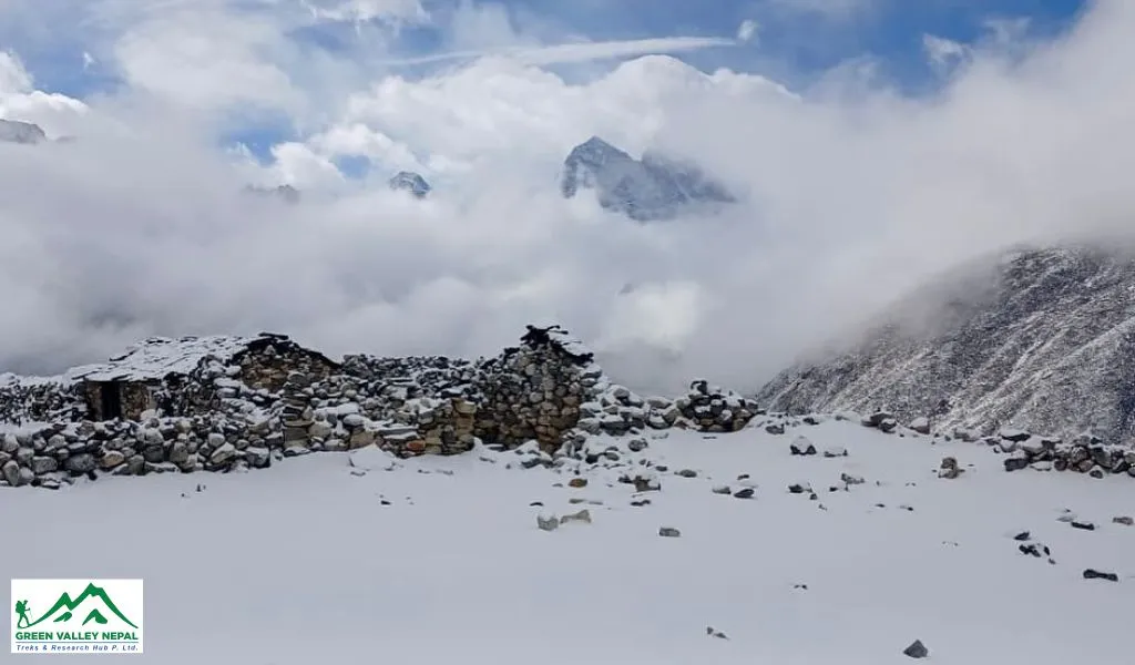
Day 5: Trek from Khola Kharka (3930m | 12894ft.) to Kothe (3691m | 12110ft.)
Today's journey will follow a rocky trail and descend downhill to Kothe (3691m | 12110 ft.), dropping the altitude by (239m | 784 ft.). The landscape then opens toward the north and east, cutting in and out of the forest before a small wooden bridge, which will be covered within 45 minutes. Further walking leads down to Kothe, over a small wooden bridge. In the race of stiff uphill and downhill trails, you will cover an approximate distance of 13 km (8.1 miles) within 6 to 7 hours.
Day 6: Trek from Kothe (3691m | 12110ft.) to Thaknak (4358m | 14298ft.)
Today’s walk is cool, as you take a gradual climb to the beautiful village, Thaknak (4358m | 14298 ft.). The surrounding jumbo peaks near it amaze the hikers. Moving further leads to a mixed trail of alpine meadows, dotted with rocky routes. Equally, the falling rocks on the left of the river are terrible.
When you step on Thaknak, a few yak herders’ huts can be seen, where you can camp or lodge warmly with a nice fire in the evening. In this beautiful mountain setting, you will be employed with a technical schedule at the very last, where you will earn your harness setup and some rope knot practice. During this, you will mark an approximate distance of 8.3 km (5.2 miles) within 3 to 4 hours.
Day 7: Trek from Thaknak (4358m | 14298ft.) to Khare (5045m | 16552ft.)
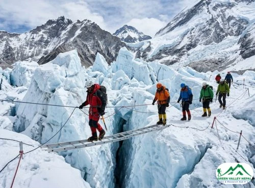
Today, you will follow a fairly direct upward path to Khare, passing over some of the past high altitudes in the east. From Thaknak, Khare is an ascent of approximately 3.3 km (2.1 miles) in distance and a height gain of (687m | 2254ft.) in approximately 4 to 5 hours. Passing through the dazzling glacier stream and the lovely lakes, an elegant Black Mera rises out of the valley. After lunch, you will step to the destination of the day, Khare, and take a rest.
Khare is the last settlement before Mera High Camp and the logical place for the base camp of a Mera Peak climbing expedition. Here, the Mera Peak trekking expedition crew often collaborates with climbing groups, sharing their expertise to the success of the expedition.
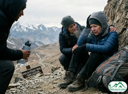
Day 8: Acclimatization or Rest day in Khare (5045m | 16552ft.)
Altitude acclimatization at Khare before Mera High Camp is critical even in good weather. Apply this time to thoroughly re-check your trekking equipment and prepare for the next day's climb.
Recently, this visitor center has been developed with good lodges offering comfortable beds, basic dining, and hot showers for trekkers to relax. Outside, colorful tents allow visitors to enjoy a campfire. A hill spanning Mera Peak above the Mera Peak Glacier and down to Taknak provides spectacular views to mountaineers.
Day 9: Trek from Khare (5045m | 16552ft.) to Mera High Camp (5780m | 18963ft.)
After a dedicated acclimatization in Khare, the Mera Peak Expedition gradually continues to the Mera High Camp (5780m | 18963 ft.). Climbing back onto the glacier moraine, similar to the preceding day, you will be going up and down snow slopes. As the expedition progresses, the walking will be on a crevasse trail; thus, walk cautiously. The non-spacious High Camp lies behind a rocky face that has limited drop-offs. From here, the Everest, Makalu, Nuptse, and Lhotse give a splendid view. When you cover 4.6 km (2.9 miles) and ascend (735m | 2411 ft.) in 6 or 7 hours, the body has more burden to bear. Consequently, rehydrate your body before the summit push.
Day 10: Ascend from High Camp (5780m | 18963ft.) to Mera Summit (6461m | 21198ft.) then descend to Khare (5045m | 16552ft.)
Finally, the waiting ends here. The peak day begins gently with a 700 m uphill climb from High Camp (5780m | 18963 ft.) to Mera Central (6461m | 21198 ft.), and then (1400m | 4593 ft.) down to Khare (5045m | 16552 ft.). Although the distance coverage is short, i.e., 4 km (2.5 miles), the walking time is long i.e., 7 to 8 hours. Therefore, an early midnight start is necessary.
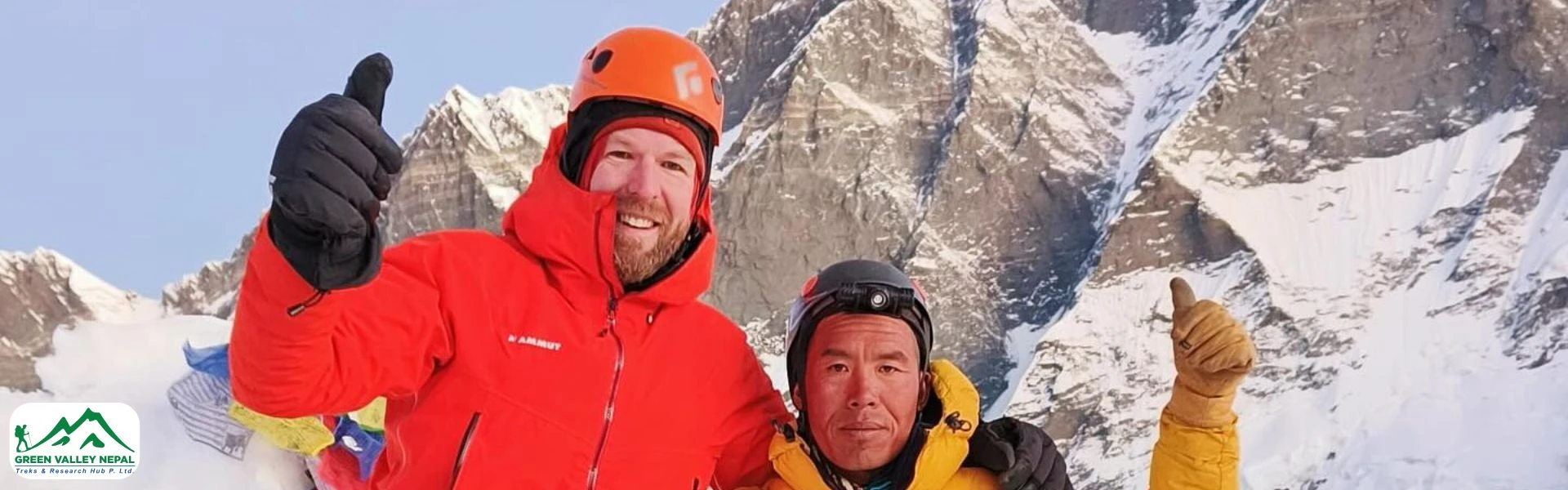
Mera Peak has three main summits: Mera North (6476m | 21217 ft.), Mera Central (6461m | 21198 ft.), and Mera South (6065m | 19898 ft.), and you are going for the top one. Shortly before reaching the summit, the route flattens slightly and bends westward along the snow plateau that leads to the Mera Summit. Reaching the (6461m | 21198 ft.) summit rewards climbers with magnificent views of Everest, Lhotse, Cho Oyu, Makalu, and Kangchenjunga. After the celebration and photography, you will descend back to Khare via High Camp.
Day 11: Trek from Khare (5045m | 16552ft.) to Kothe (3600m | 11811ft.)
After a long hiking day, you will retrace your way back to Kothe. Taking the downhill route, you will drop an altitude of (1445m | 4741 ft.) to Kothe via Thaknak. It will cover a trek distance of approximately 13.5 km (8.4 miles) in 6 to 7 hours.
Day 12: Trek from Kothe (3600m | 11811ft.) to Chetarwa (3580m | 11745ft.)
Instead of following the path of Khola Kharka, you will prefer the different path that takes you to Lukla quickly. Following a thick rhododendron forest, a few ridges, you will initially ascend and later descend to a lodge for lunch. After lunch, you will move toward the day’s destination, Chetarwa, within 6 to 7 hours of hiking and cover an average distance of 6.5 km (4 miles).
Day 13: Trek from Chetarwa (3580m | 11745ft.) to Lukla (2800m | 9186ft.)
Today is your last day in the mountainous territory. After a hearty breakfast in Chetarwa, you will head down to Lukla via several settlements, waterways, and woodland routes. As you reach Lukla Airport, enjoy the victory of the Mera Peak Expedition. Before you head back to Kathmandu, chill out the rest of the day. The day is not easy, as you cover a roughly 15 km (9.3 miles) distance within 6 to 7 hours.
Day 14: Flight from Lukla (2800m | 9186ft.) to Kathmandu (1400m | 4593ft.)
Depending on your departure schedule, head to the Tenzing Hillary Airport. If the weather permits, you will depart the Everest region on this day and land in Kathmandu, enjoying the scenery from the window.
Difficulties of Mera Peak Expedition Distance
The hiking trail to the Mera Summit is quite taxing, exceeding the 6,000 m threshold. Despite its high altitude, the distance to cover from the very beginning, combined with long trekking days, fluctuating weather patterns, and tough rocky trails, makes the Mera Peak climb a difficult one. To overcome such challenges efficiently, you must be physically and mentally stable. Trekking agencies offer a pre-trip training session to deliver a cool and successful mountain climbing experience.
Training Tips for Mera Peak Expedition Distance
The total distance, expedition duration, insurance policy, total expenses involved, and cost-saving strategies are primary considerations that deserve detailed examination before booking the expedition.
Generally, the Mera Peak Expedition is not regarded as a technical ascent. However, the height of Mera Peak (6,461 m) and the trek duration are long; every struggle here will make you exhausted, and require excellent endurance. Before the actual Mera Peak Climb, the best training session is favored. Likewise, light exercises, such as cycling, swimming, and running, are great for your cardiovascular strength. Additionally, you can also prefer a gym, a short uphill walk, or a meditation session for the best results.
Every training may not suit all. However, a fitness test is significant before training. Furthermore, mountaineering courses, technical climbing skills, ice axe, rope, crampon techniques, and glacier navigation are foremost for the Mera Peak Expedition.
Most climbers prefer guided expeditions, yet an increasing number of climbers undertake independent expeditions. Nonetheless, we offer a guided expedition with a porter to support climbers, prioritizing climbers’ safety. Significantly, a carefully designed itinerary, proper acclimatization plans, physical fitness, weather windows, and professional guidance will enhance the success rate of the Mera Peak Expedition.
Trek Essentials for Mera Peak Expedition Distance
Without the right gear and equipment, every trip is bound to be a disaster. Therefore, pack genuine and versatile trekking necessities for an enjoyable and fulfilling experience on the Mera Peak Expedition. The following clothing and supplies set equips an adventurer well for the Mera Peak Expedition and for many other 6,000 m summits.
A Backpack, sleeping bag, down jacket, thermal wear, a waterproof and windproof outfit, best hiking boots, personal accessories, etc., should be listed in your packing checklist. More on technical items such as harnesses, crampons, and ice axes assumes greater importance. For a detailed packing list, please refer to our experts’ verified and recommended packing checklist. When loading, bear only the necessary belongings for a burden-free adventure.
Conclusion
The daily distances covered during a Mera Peak climbing expedition vary depending on the route and itinerary you prefer. When trekking with us, you will cover a rough distance of 110.9 km in an outstanding 2-week trip. Before booking, research the altitude, distance, weather, and challenges of the trek genuinely. So you can set yourself up for an everlasting mountainous experience.
Frequently Asked Questions (FAQs)
- Can I see Mt. Everest from Mera Peak?
Of course, yes. Located 19.5 miles from the Everest, this 6,461 m high-altitude giant peak offers stunning views of five 8,000 m peaks, including Mt. Everest.
- How can I get from Kathmandu to Lukla?
Most climbers opt for a 35-minute air ride to Lukla. However, a 22 to 24-hour bumpy road ride is also possible from Kathmandu.
- How long does it take to scale Mera Peak?
Actually, Mera Peak is not demanding, and it does not include technical ascent. However, the uphill and downhill climbs on off-road trails with a supreme altitude of 6,461 m make it challenging, and it takes 7 to 8 hours to reach the Mera summit.
- Is Mera Peak suitable for beginners?
Generally, Mera Peak does not require climbing experts to climb. Trekkers with basic mountaineering skills and previous trekking experience on high mountains can successfully achieve the trek. However, this high-altitude expedition is not recommended for the fresher.