Understanding the Everest Base Camp Trek Map
Embarking on the Everest Base Camp Trek is a dream for many adventure seekers. This iconic trek offers breathtaking landscapes, cultural encounters, and the chance to stand at the foot of the world's highest peak. It is essential to have a thorough awareness of the route, landmarks, and elevations to guarantee a safe and pleasurable voyage. We will go into great detail in this blog post on the Everest Base Camp Trek Map and the Everest Base Camp Trek Altitude Map, giving you helpful tips to help you get about on this incredible journey.
Everest Base Camp Trek Map

Embarking on the legendary Everest Base Camp Trek is an adventure of a lifetime. To navigate through the rugged terrain and ensure a safe and memorable journey, trekkers rely on the Everest Base Camp Trek Map—a comprehensive visual guide that provides essential information about the route, topography, trails, and markers along the way. Let's explore the features of this invaluable map.
- Route and Trails: The Everest Base Camp Trek Map outlines the entire trekking route from Lukla to Everest Base Camp, ensuring that trekkers stay on the designated trail. It marks the key villages, rest stops, and acclimatization points, allowing trekkers to plan their itinerary and estimate distances between each location. The map acts as a reliable companion, guiding trekkers through the picturesque landscapes and challenging terrains of the Khumbu region.
- Topography: One of the most important features of the Everest Base Camp Trek Map is its depiction of the topography of the region. It gives hikers a vivid picture of the terrain they would experience by showcasing the tall Himalayan peaks, glaciers, valleys, and rivers. The map helps trekkers anticipate changes in elevation, prepare for steep ascents or descents, and navigate through various types of terrain, from dense forests to rocky moraines.
- Altitude Markers: An essential component of the Everest Base Camp Trek Map is the inclusion of altitude markers. These markers indicate the elevation at various points along the route, allowing trekkers to track their progress and manage altitude-related challenges. By referring to the map, trekkers can plan their ascent gradually, ensuring proper acclimatization and reducing the risk of altitude sickness. The altitude markers provide crucial information for maintaining a safe and enjoyable trekking experience.
- Landmarks and Points of Interest: The Everest Base Camp Trek Map highlights significant landmarks and points of interest along the route. These may include villages like Namche Bazaar, Tengboche Monastery, Dingboche, Lobuche, and, of course, the ultimate destination—Everest Base Camp itself. By referencing the map, trekkers can identify these landmarks and plan their rest stops, explore cultural sites, and marvel at breathtaking vistas along the way. The map adds depth and context to the trek, enhancing the overall experience.
- Safety Information: The Everest Base Camp Trek Map also provides valuable safety information to ensure a secure trekking experience. It may include important details such as emergency contact numbers, nearby medical facilities, and potential hazards to be aware of. By consulting the map, trekkers can make informed decisions, avoid risky areas, and prioritize their well-being throughout the journey.
Exploring the 14-Days Everest Base Camp Trek Route
The Everest Base Camp Trek is a legendary adventure that takes you through awe-inspiring landscapes and cultural treasures. Starting from the mountain airstrip at Lukla, the route winds its way through the Khumbu region, offering breathtaking views and unforgettable experiences. Let's delve into a general overview of the route from Lukla to Everest Base Camp, highlighting key locations and landmarks along the way.
- Lukla (2,860m): Lukla serves as the starting point of the Everest Base Camp Trek and is renowned for its unique features. The small town is nestled among mountains and offers a thrilling mountain airstrip experience. Trekkers are welcomed by a stunning view of the Himalayas as they land at one of the toughest airports in the world. Lukla also provides a glimpse into the Sherpa culture, with traditional houses and friendly locals setting the stage for an incredible adventure.
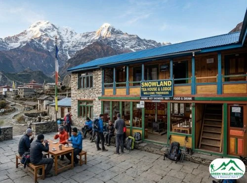
- Namche Bazaar (3,440m): Namche Bazaar is a bustling Sherpa town and plays a significant role as an acclimatization stop during the Everest Base Camp Trek. This vibrant hub is known as the gateway to the Everest region. It offers a variety of amenities, including cozy lodges, shops, bakeries, and a vibrant market. Trekkers can immerse themselves in the rich Sherpa culture, explore the Sherpa Museum, and enjoy stunning panoramic views of Everest, Lhotse, and Ama Dablam from various vantage points.
- Hotel Everest View (3,880m): The magnificent Hotel Everest View blends seamlessly with its spectacular surroundings and is positioned on a ridge with a panoramic view of the Everest range. Every lodging has a view of Mt. Everest, allowing visitors to indulgently take in this alluring setting. The Hotel Everest View at a height of 3880 meters was established in 1971 and is the highest hotel in the world in 2004 as per Guinness Book of World Records data. The resort has grown to become a unique travel destination, making appearances in several guidebooks and garnering media interest. In addition to soaking in the gorgeous surroundings, which are made up of rhododendron forests, bushes, and evergreen fir trees, it is the ideal site to begin visiting the adjacent communities.
- Tengboche (3,860m): Tengboche is a must-visit location on the Everest Base Camp Trek, primarily because of its iconic Tengboche Monastery. This ancient Buddhist monastery holds great cultural significance in the region and is the largest monastery in the Everest area. Situated amidst breathtaking scenery, the monastery offers a tranquil and spiritual atmosphere. Trekkers often have the opportunity to witness morning prayers and ceremonies, accompanied by panoramic views of Everest, Nuptse, and Kwangde.
- Dingboche (4,410m): Dingboche is a picturesque village nestled in a valley and surrounded by towering peaks. It is a crucial location for acclimatization during the Everest Base Camp Trek. The stunning landscapes of Dingboche captivate trekkers with their barren yet awe-inspiring beauty. Trekkers can enjoy panoramic views of Ama Dablam and Island Peak and take short hikes to neighboring viewpoints. This allows the body to adjust to the increasing altitude gradually, reducing the risk of altitude-related illnesses.
- Lobuche (4,940m): Lobuche is a significant location on the Everest Base Camp Trek, known for its challenging terrain and proximity to Everest. It acts as a resting point for trekkers before the final ascent to Everest Base Camp. The rocky moraine and the Khumbu Glacier create a dramatic and awe-inspiring setting. From Lobuche, trekkers can catch glimpses of Everest and witness the somber memorials dedicated to climbers who lost their lives on the mountain.
- Everest Base Camp (5,364m): The ultimate destination of the Everest Base Camp Trek, Everest Base Camp itself, is an awe-inspiring location. It provides hikers with a dreamlike experience and a sense of success because it is situated at the base of the world's tallest peak. Surrounded by massive glaciers, including the Khumbu Icefall, trekkers can witness firsthand the raw power and beauty of the Everest region. Standing at Everest Base Camp, with Everest towering above, is an unforgettable moment for every adventurer.
- Kala Patthar (5,545m): While not an official stop on the Everest Base Camp Trek route, Kala Patthar is a popular vantage point for panoramic views of Everest. Many trekkers choose to make the additional ascent to Kala Patthar to witness the sunrise and capture breathtaking photographs of the Everest summit. From this viewpoint, the immense scale of the Himalayas becomes even more apparent, leaving trekkers in awe of the majestic peaks and the surrounding landscape.
These essential locations along the 14-day Everest Base Camp Trek offer trekkers a diverse range of experiences, from cultural immersion to breathtaking natural beauty. Each location holds its own significance and contributes to the overall adventure and sense of accomplishment that comes with reaching Everest Base Camp.
Navigating the Everest Base Camp Trek Altitude Map

Everest Base Camp Trek Altitude Chart Map
The Everest Altitude Chart Map is a powerful tool that provides a clear visualization of altitude gain and key acclimatization stops along the Everest Base Camp Trek. It serves as an essential resource for trekkers, helping them understand the elevation profile of the trek and plan their ascent accordingly. Let's explore the purpose and benefits of the Everest Altitude Chart Map in detail.
- Understanding Altitude Gain: The Everest Altitude Chart Map displays a visual representation of the altitude gain throughout the trek. It showcases the gradual ascent from the starting point in Lukla to the ultimate destination at Everest Base Camp. By studying the altitude chart, trekkers can get a sense of the steepness and intensity of each section of the trek. This allows them to mentally prepare for the challenges ahead and plan their pace accordingly.
- Identifying Key Acclimatization Stops: One of the crucial aspects of a successful Everest Base Camp Trek is acclimatization. The Everest Altitude Chart Map highlights key acclimatization stops along the route, such as Namche Bazaar, Dingboche, and Lobuche. These designated rest days provide trekkers with an opportunity to adjust to the increasing altitude and allow their bodies to adapt gradually. By referring to the altitude chart, trekkers can identify these crucial acclimatization points and plan their itinerary accordingly, ensuring they allocate sufficient time for rest and acclimatization.
- Planning the Trek: The Everest Altitude Chart Map enables trekkers to plan their trek effectively by understanding the elevation changes and the distribution of acclimatization stops. It allows them to visualize the overall ascent and strategically determine their pace and rest days. This planning aspect is crucial for a safe and enjoyable trek, as it helps trekkers maintain a gradual ascent, minimize the risk of altitude-related illnesses, and optimize their chances of successfully reaching Everest Base Camp.
- Assessing Fitness and Readiness: The altitude chart also serves as a tool for trekkers to assess their fitness and readiness for the Everest Base Camp Trek. By studying the elevation gain and the altitude of various stops along the route, trekkers can evaluate their physical preparedness and make informed decisions regarding their trek. It provides valuable insights into the challenges they may face, allowing them to adequately train and prepare themselves for the journey ahead.
Understanding Altitude and Acclimatization
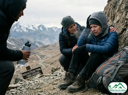
Altitude plays a significant role in the Everest Base Camp Trek, as trekkers ascend to higher elevations and venture into the realm of the world's tallest mountains. Comprehending the effects of altitude on the body and the importance of acclimatization is crucial to this amazing adventure. Let's explore the significance of altitude and the challenges of acclimatization, emphasizing the need for a gradual ascent.
- Altitude and its Effects: As trekkers ascend higher into the Everest region, the air becomes thinner, and the oxygen levels decrease. This decrease in oxygen flow might direct to altitude-related problems including altitude sickness, which can possess headaches, nausea, dizziness, and exhaustion. It is important to identify and discourse these symptoms immediately to prevent more dangerous illnesses like high-altitude pulmonary edema (HAPE) and high-altitude cerebral edema (HACE).
- The Role of Acclimatization: The process through which the body adjusts to lower oxygen levels at higher elevations is known as acclimatization. The body adjusts gradually to the low-oxygen environment in order to perform at its best. Acclimatization causes physiological modifications such as enhanced red blood cell synthesis and better oxygen use. To facilitate acclimatization, trekkers must allow their bodies enough time to adjust to the changing altitude by taking rest days and ascending gradually.
- Challenges and the Need for Gradual Ascent: One of the primary challenges of the Everest Base Camp Trek is managing the risk of altitude-related illnesses while continuing the ascent. A key strategy to mitigate these risks is a gradual ascent, allowing the body sufficient time to acclimatize to each new altitude. Rushing the trek or ascending too quickly increases the likelihood of experiencing altitude sickness.
A gradual ascent typically involves spending extra nights at specific acclimatization points, such as Namche Bazaar, Dingboche, and Lobuche. These rest days provide an opportunity for the body to adjust to the altitude before proceeding to higher elevations. Trekkers can use this time to explore the surroundings, take short hikes, and let their bodies adapt to the reduced oxygen levels.
An Everest Base Camp Trek Altitude Map can serve as a valuable tool for understanding the elevation changes and planning the trek accordingly. It indicates the altitudes at different points along the route, allowing trekkers to track their ascent and plan for acclimatization stops.
By following a well-designed itinerary and paying attention to their bodies' signals, trekkers can enhance their chances of successful acclimatization and a safe, enjoyable journey to Everest Base Camp. Remember, the key is to listen to your body, maintain a gradual ascent, and prioritize acclimatization to fully appreciate the majestic beauty of the Everest region while minimizing the risks associated with high altitude.
Conclusion
With the detailed insights provided by the Everest Base Camp Trek Map and the Everest Altitude Chart Map, you are well-equipped to embark on this remarkable journey. Plan your route, understand the altitudes, and make the most of the essential locations along the 14-day trek. Remember, safety and acclimatization should always be prioritized. So, gather your gear, lace up your boots, and get ready to experience the majesty of the Everest Base Camp Trek while confidently navigating the route with your trusted maps.
With the help of the above-mentioned Everest Base Camp Trek Map and the Everest Altitude Chart Map, you can participate in the following packages offered by Green Valley Nepal Treks.