This incredible voyage begins with the 12 Days Everest Base Camp Trek, which offers an adventure that mixes the majesty of nature's grandeur with the exhilaration of scaling new peaks. It's an opportunity to experience the compelling 12-day adventure to the Everest Base Camp and the beautiful Himalayas, which go beyond just a physical test. The 12 Days Everest Base Camp Trek Route Map serves as your reliable companion while you train for your journey, guiding you through breathtaking scenery and giving you a sense of the incredible altitudes you'll encounter along the way.
12 Days Everest Base Camp Trek Route Map and Altitude Chart
Table of Contents
12 Days Everest Base Camp Trek Route Map

An exciting excursion that reveals the enchanting grandeur of the Himalayas is the 12 Days Everest Base Camp Trek. The well-planned route map that leads hikers through a variety of terrain, from lush valleys to towering peaks, forms the basis of this experience. This crucial tool ensures that you not only reach the base camp but also fully immerse yourself in the breathtaking scenery along the route, serving as your compass to an amazing experience.
Importance of 12 Days Everest Base Camp Trek Route Map
The route map is more than simply a piece of paper or a photograph to store on your device; it serves as a key to the Himalayas' secret attractions. It holds the secret to comprehending the route you'll take, the heights you'll scale, and the cultural treasures you'll come across on the way. By arming you with knowledge, the "12 Days Everest Base Camp Trek Route Map" enables you to emotionally and physically get ready for the difficulties and miracles that lie ahead. It makes sure that you don't just follow a track but rather integrate with the environment, taking each step with intention.
Exploring the 12 Days Everest Base Camp Trek Route Map
Before the expedition even starts, you are traveling virtually as you move your finger around the route map. You'll learn the trail's secrets, including those of the luxuriant forests, charming communities, and expansive vistas that lie ahead. Each contour line on the map tells a tale and offers a distinct viewpoint of the characteristics of the landscape. It's a dynamic story of height, excitement, and the friendship of fellow hikers rather than merely a static representation. The "12 Days Everest Base Camp Trek Route Map" allows you to delve into the experience's core and establish a connection with the location before taking a single step.
12 Days Everest Base Camp Trek Altitude Chart

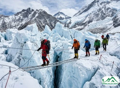
Embarking on the 12 Days Everest Base Camp Trek means embracing the exhilarating challenge of ascending to remarkable heights. The Everest Base Camp Altitude Chart stands as a visual testament to the vertical journey that awaits. As you trace the chart's lines, you'll uncover a narrative of altitude gain, revealing the gradual ascent and the varying challenges each elevation brings.
Understanding Altitude and Its Implications on Everest Base Camp Trek
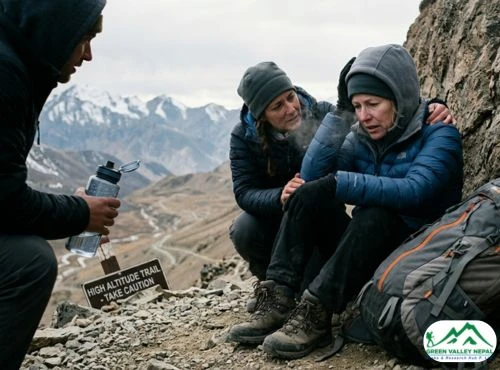
Your trekking experience is shaped by altitude, which is more than simply a number. Your body must adapt to the changing conditions as you climb higher into the Himalayas and the air gets thinner. The Everest Base Camp Trek crosses altitudes from charming towns to the famous base camp. Each change in altitude has effects on your physical health, therefore you must pay close attention to your body's warnings. The altitude chart is more than just a picture; it's a guide to understanding how temperature, oxygen levels, and demands on your cardiovascular system alter as you ascend higher into the atmosphere. You can prepare yourself to take on the adventure with assurance and preparedness by understanding these ramifications.
Purpose of the 12 Days Everest Base Camp Trek Altitude Chart
The Everest Base Camp Altitude Chart isn't just a static piece of information; it's a strategic tool that empowers trekkers. Its purpose extends beyond showcasing numbers; it provides insight into the challenges and rewards at each altitude milestone. Trekkers can utilize the chart to plan their journey, pacing themselves to ensure a safer and more enjoyable experience. By identifying the high points and rest stops, you can align your physical efforts with the terrain, allowing for optimal acclimatization and minimizing the risk of altitude-related issues.
Important Location on 12 Days Everest Base Camp Trek Map
As you embark on the 12 Days Everest Base Camp Trek, certain key locations stand as pivotal milestones in your journey. Each place not only marks a change in elevation but also carries its own unique charm and significance.
Kathmandu (1400m)
The action-packed Nepalese metropolis of Kathmandu is where your Everest journey starts. This city, which is tucked away in the Kathmandu Valley, is a fusion of old heritage with cutting-edge vitality. You'll complete your preparations here while taking in the colorful marketplaces and the rich cultural diversity before your trip to Lukla. Please keep in mind Lukla flights are diverted to Ramechhap as per instruction given by CAAN.
Lukla (2840m)
After a scenic mountain flight, you'll arrive in Lukla, the gateway to the Everest region. Perched at an elevation of 2840 meters, Lukla welcomes you with its breathtaking landscape and Sherpa hospitality. From here, your trekking journey officially commences, as you make your way towards the higher altitudes.
Phakding (2610m)
The village of Phakding is your first stop on the trail, located at an elevation of 2610 meters. Nestled along the banks of the Dudh Koshi River, Phakding offers a serene setting amidst lush forests and charming teahouses. It's the perfect place to acclimatize and connect with fellow trekkers, as you prepare for the adventures that lie ahead.
Namche Bazaar (3440m)
Namche Bazaar, a thriving Sherpa hamlet located at an altitude of 3440 meters, is a key stopping point on the 12-day Everest Base Camp Trek. Namche Bazaar welcomes you with its lively marketplaces, inviting teahouses, and stunning views as you climb higher into the Himalayas. This charming village provides a well-earned break and acts as a key location for acclimatization. This place offers a distinctive fusion of Sherpa culture and contemporary conveniences, making it a fascinating rest stop on your walk.
Phortse (3810m)
Perched at an elevation of 3810 meters, Phortse is a tranquil village that beckons trekkers with its serene beauty and mountain vistas. This lesser-known gem is an oasis of tranquility, nestled amid the rugged terrain of the Everest region. Phortse offers a glimpse into the local way of life, as you interact with the welcoming Sherpa community. The village serves as a reminder that the journey isn't just about reaching the destination but also about forging connections with the people and places that shape this remarkable landscape.
Dingboche (4410m)
As you ascend to an elevation of 4410 meters, Dingboche comes into view, offering a high-altitude haven that captures the essence of the Everest trek. Surrounded by towering peaks, Dingboche is a place where trekkers catch their breath and marvel at the majestic surroundings. The village is a testament to the resilience of the human spirit, with its stone-walled fields and warm hospitality. Dingboche marks a significant elevation gain, reminding you of your progress and preparing you for the awe-inspiring heights that lie ahead.
Dughla (4620m)
Perched at an elevation of 4620 meters, Dughla is a rugged outpost on the 12 Days Everest Base Camp Trek. As you ascend higher into the thinning air, Dughla offers a stark yet captivating landscape. The terrain is a reminder of the challenges that come with higher altitudes, and the air is filled with a sense of achievement as you approach this waypoint. Dughla's altitude signifies your progress and serves as a bridge to the heights that await you.
Lobuche (4910m)
At an elevation of 4910 meters, Lobuche welcomes trekkers with a sense of remoteness and adventure. The village sits nestled amidst the Himalayan grandeur, offering panoramic views that inspire awe. Lobuche serves as a stepping stone to the Everest Base Camp and Kala Patthar, providing a base for exploration and acclimatization. The thin air reminds you that you're on the path to something extraordinary, and the camaraderie of fellow trekkers makes the journey even more memorable.
Gorakshep (5140m)
As you reach an elevation of 5140 meters, Gorakshep becomes the gateway to your ultimate destination—the Everest Base Camp. This high-altitude haven is surrounded by towering peaks and glacial landscapes. The air is crisp and the anticipation is palpable as you prepare to fulfill your goal. Gorakshep is where trekkers gather their strength for the final push, with the base camp just a breath away. This altitude is a testament to your determination and the realization of a dream that's been building since the start of your journey.
Everest Base Camp (5364m)
The Everest Base Camp, at a height of 5364 meters, is the apex of your 12-day trek to the base camp. This famous spot is more than simply a place to go; it's a symbol of your willpower and the end of your quest. You will have a strong sense of connection to the climbing past and the stunning surroundings as you stand amidst the magnificence of the towering peaks. Although the air may be thin, you are filled with an overwhelming sense of success as you stare upon the majestic Mount Everest and celebrate having arrived at this well-known location.
Kala Patthar (5555m)
Ascending to a height of 5555 meters, Kala Patthar offers a vantage point that grants you an unrivaled panoramic view of the Everest region. It's here that trekkers gather to witness the sunrise painting the peaks with hues of gold and pink. Kala Patthar is a place of reverence, a platform that allows you to not only see the mountains but also feel their magnitude. The altitude reminds you that you're in rarified air, and the views serve as a reminder of the awe-inspiring beauty that nature has to offer.
Pheriche (4240m)
Nestled at an elevation of 4240 meters, Pheriche is a haven of hospitality and rest on your return journey. As you descend from the heights of Everest Base Camp and Kala Patthar, Pheriche welcomes you with its warm embrace. The lower altitude brings a sense of comfort, and the village offers a chance to reflect on the journey you've completed. Pheriche is a place of connection, where trekkers share stories and appreciate the camaraderie that's formed along the trail.
Conclusion
In the epic saga of the 12 Days Everest Base Camp Trek, the route map and altitude chart emerge as indispensable companions. These tools aren't just guides; they're the keys that unlock the breathtaking landscapes, challenge thresholds, and connect trekkers to the heartbeat of the Himalayas. The map illuminates the path, unveiling hidden gems and marking milestones. The altitude chart, a silent advisor, prepares for the heights and safeguards against risks. Together, they transform a journey into an odyssey—empowering adventurers to conquer physical heights, and emotional barriers, and create memories that will echo for a lifetime.

Arjun Pandey
Call us on WhatsApp+977 9841 392186OrChat with us