How Long Is the Annapurna Circuit Trek?
The Annapurna Circuit covers between 160 km and 230 km, and the gap between those two numbers comes down almost entirely to your starting point and how much of the lower valley you drive instead of walk.
Most trekkers who do the classic route, starting in Besisahar and finishing in Nayapul via Pokhara, walk approximately 190–200 km over 15–18 days, which works out to roughly 118–125 miles.
Here's what actually shapes your personal total:
- Your starting point: Besisahar, Dharapani, and Chame all give very different totals, since each cuts a different chunk of the lower Marshyangdi valley.
- Your ending point: Jomsom, Nayapul, or Pokhara.
- Side trips: Tilicho Lake adds roughly 12–15 km round trip, Poon Hill adds about 8 km, and Ice Lake near Manang adds around 10 km.
- How much of the road you drive: Most trekkers now jeep the first dusty stretch to Dharapani or Chame, cutting out roughly 40–50 km of walking that runs alongside a dirt road anyway.
Once you factor in the jeep shortcut, the pure trekking section, the part you are actually on foot for, comes down to around 130–160 km. It's still a serious multi-day trek, just concentrated on the best parts of the trail.
How Far Is the Drive to the Annapurna Circuit Trailhead?
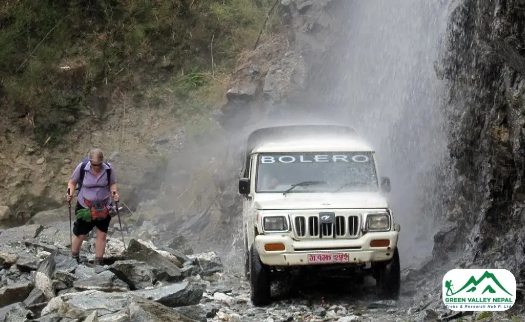
Since so much of the western Annapurna Circuit is now road-accessible, part of your "distance" happens by vehicle before you ever put boots on the trail. Here's roughly what that looks like:
- Kathmandu to Besisahar: ~175–195 km by road (6–7 hours)
- Kathmandu to Dharapani (via Besisahar): ~215–230 km by road (8–10 hours)
- Kathmandu to Chame: ~230–240 km by road (9–11 hours)
- Muktinath/Jomsom to Pokhara (return leg): ~200 km by road, or a short 20-minute flight from Jomsom
These driving distances aren't part of your "trekking distance," but they matter for planning your itinerary length and budgeting travel days, especially if you are flying into Kathmandu and trying to work out how many total days to block off.
Annapurna Circuit Trek Distance: Day-by-Day Breakdown
The table below shows the classic 15–18 day full circuit from Besisahar to Nayapul. Some days are short on distance but long on hours, because altitude and steep terrain slow you down far more than flat kilometers ever would. If you are also wondering what the teahouses and nightly costs look like along this route, our Annapurna Circuit Accommodation Guide covers that stop by stop.
Day / Route | Distance (km) | Distance (miles) | Walking Time | Altitude |
Besisahar to Chamje (drive) | ~20 km | ~12.4 mi | Drive day | 820m → 1,410m |
Chamje to Dharapani | 9 km | 5.6 mi | 5–6 hrs | 1,410m → 1,860m |
Dharapani to Chame | 22 km | 13.7 mi | 6–7 hrs | 1,860m → 2,670m |
Chame to Pisang | 8 km | 5.0 mi | 5–6 hrs | 2,670m → 3,300m |
Pisang to Manang | 11 km | 6.8 mi | 4–5 hrs | 3,300m → 3,540m |
Manang (acclimatization day) | 4–6 km hike | 2.5–3.7 mi | 4–5 hrs | 3,540m |
Manang to Yak Kharka | 6 km | 3.7 mi | 4–5 hrs | 3,540m → 4,090m |
Yak Kharka to Thorong Phedi | 4 km | 2.5 mi | 4 hrs | 4,090m → 4,450m |
Thorong Phedi to Muktinath (via Thorong La Pass) | 10 km | 6.2 mi | 7–8 hrs | 4,450m → 5,416m → 3,800m |
Muktinath to Tatopani (drive) | ~100 km | ~62 mi | 6–7 hrs | 3,800m → 1,190m |
Tatopani to Shikha | 9 km | 5.6 mi | 4 hrs | 1,190m → 1,935m |
Shikha to Ghorepani | 6 km | 3.7 mi | 3 hrs | 1,935m → 2,860m |
Poon Hill + trek to Tadapani | 16 km | 9.9 mi | 7 hrs | 2,860m → 3,210m → 2,630m |
Tadapani to Ghandruk | 9 km | 5.6 mi | 3 hrs | 2,630m → 1,940m |
Ghandruk to Nayapul (+ drive to Pokhara) | 10 km walk | 6.2 mi | 4 hrs walk | 1,940m → 1,070m |
Note: Distances are approximate. Terrain, pace, and route variations (some itineraries route via Ngawal or skip Tatopani by jeep) can shift daily totals by a few kilometers.
Why Daily Distance Matters More Than Total Distance
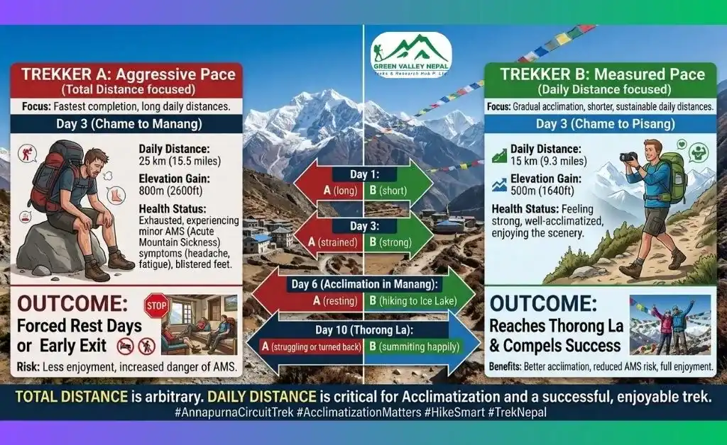
Here's something the headline number- 160 km, 190 km, and 230 km- doesn't tell you: a 10 km day at 4,500 meters has almost nothing in common with a 10 km day at sea level.
Once you are above roughly 3,500 meters, your body is working with noticeably less oxygen. Your pace drops, your breathing gets heavier, and recovery between days takes longer, even if the kilometers on paper look modest. That's why the Thorong La Pass crossing, at only 10–16 km, is universally rated the hardest day of the trek, while a 20+ km descent day through the Kali Gandaki Valley can feel comparatively easy on the lungs (even if it's tougher on the knees).
You will also spend several consecutive days above 3,000 meters, roughly from Chame through Muktinath, before dropping back into thicker air near Tatopani. That's the real reason well-designed itineraries shorten the daily distance as you climb: Manang to Yak Kharka is only 6 km, Yak Kharka to Thorong Phedi is only 4 km, while the lower, oxygen-rich sections cover 15–22 km in a single day without much extra strain.
Practical Takeaway
Don't judge a day's difficulty by its kilometers alone. Check the altitude and elevation change alongside the distance, and always build in at least two nights in Manang (3,540m) before pushing higher; that single acclimatization day does more for your Thorong La crossing than any amount of pre-trek cardio training. For a visual, elevation-by-elevation view of the whole trail, see our Annapurna Circuit Trek Map and Altitude Chart.
Thorong La Pass: The Highest Point and the Toughest Distance
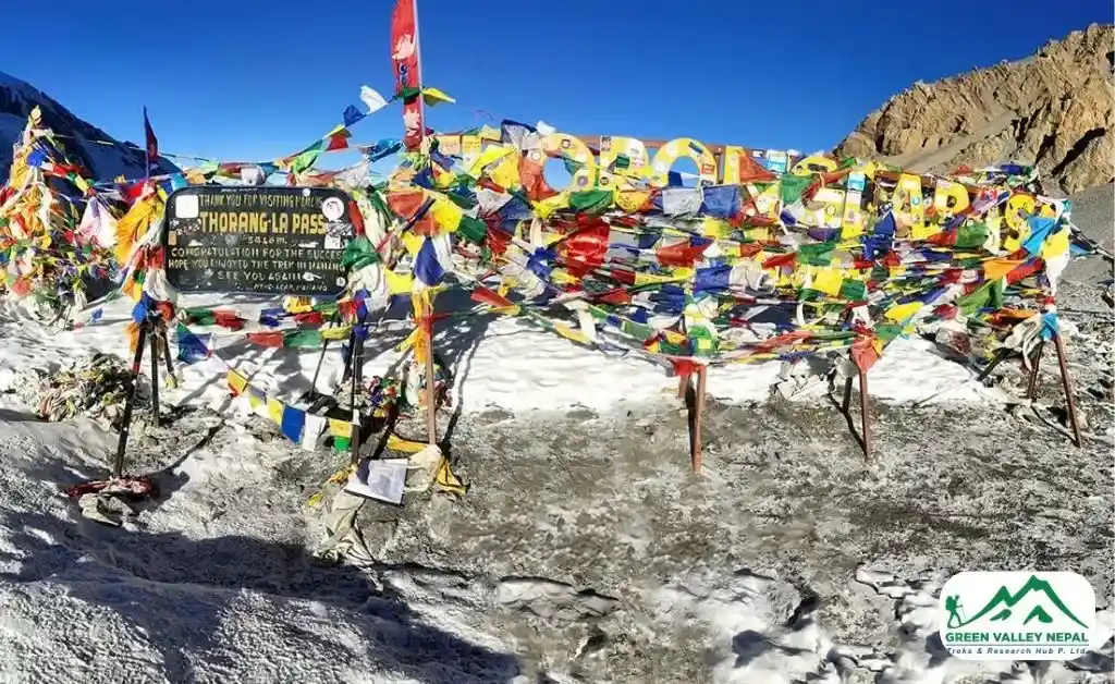
The highest point on the Annapurna Circuit is Thorong La Pass, sitting at 5,416 meters (17,769 feet). It's the day most trekkers worry about, and rightly so.
- Start: Thorong Phedi (4,450m) or High Camp (4,925m)
- Distance to the pass: ~5–6 km
- Pass to Muktinath: ~10–11 km
- Total for the day: 13–16 km, in 7–9 hours
You will start before dawn, often around 4 AM, because winds on the pass pick up dangerously after 10 AM. There's no alternative route; crossing Thorong La is the only way to complete the circuit, and it's also widely considered one of the most rewarding single days in Himalayan trekking.
Pro Tip
Spend at least two nights in Manang before heading higher. That extra acclimatization day makes the Thorong La crossing feel far more manageable, both physically and mentally. The season you travel in also changes how comfortable this crossing feels; see our Annapurna Circuit Trek Best Time guide for a month-by-month breakdown.
How Road Construction Has Changed the Annapurna Circuit's Distance
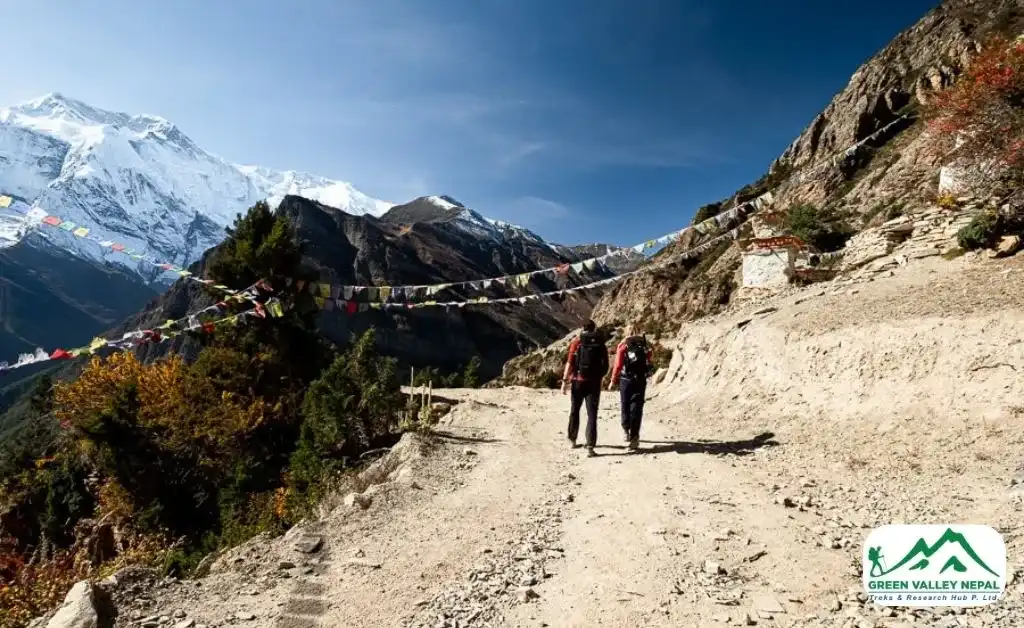
If you have read older trekking accounts describing a 230+ km, three-week trek starting in Besisahar, you are reading about a trail that's changed significantly. Over the past decade, roads have crept further into the Marshyangdi and Kali Gandaki valleys from both ends, reaching Chame in the east and past Muktinath in the west.
That road access is exactly why you will see such a wide distance range quoted across the internet:
- Pre-road era: The full walking route from Besisahar to Nayapul covered up to 230 km, taking 18–21 days.
- Today's standard trek: Most trekkers jeep the dusty lower stretch to Dharapani or Chame, cutting the walking distance to roughly 160–190 km over 12–15 days.
- NATT trails: In response to the roads, communities have developed alternative "Natural Annapurna Trekking Trails" (NATT) that route around the jeep roads through forests and villages, preserving the trekking experience while adding back some of the distance the road removed.
The upside of the road is time saved and less dust underfoot in the lower valleys; the trade-off is that some of the original cultural villages between Besisahar and Chame are seen less often. Everything from Manang onward to Thorong La, Muktinath, the Kali Gandaki Valley, and Poon Hill remains entirely on foot and untouched by the road. This same road-versus-trail trade-off is playing out across the wider Annapurna region; we go into it in more depth in our Annapurna Base Camp Trek budget breakdown.
Classic Route vs Shortened Route: Which Distance Is Right for You?
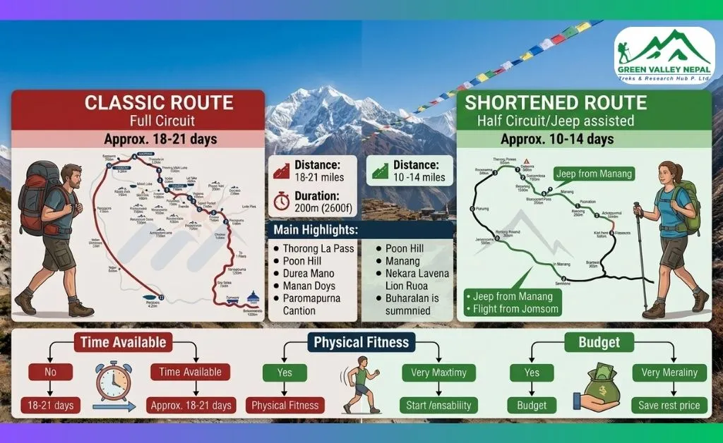
Full Classic Circuit (~190–230 km)
The full classic Annapurna Circuit trek is the original route most trekkers follow, walking from the low hills of the Marshyangdi River Valley all the way around the Annapurna massif to Nayapul or Pokhara. You get the lush subtropical forests at the start, the high-altitude desert around Manang, the sacred site of Muktinath, the hot springs at Tatopani, and the sunrise at Poon Hill.
- Best for: Trekkers with 16–18 days who want the complete experience and don't mind a short jeep ride through the early, road-adjacent sections.
Shortened High-Altitude Route (~110–160 km)
Most modern trekkers drive from Kathmandu or Pokhara to Dharapani or Chame, skipping the lower sections that now run alongside a dirt road. From Chame, you still have around 80–100 km of proper mountain trail ahead, including Manang, Thorong La, Muktinath, and Poon Hill.
- Best for: Trekkers with 12–14 days who want to focus their energy on the high-altitude highlights.
Short Annapurna Circuit (~100–160 km)
The short Annapurna Circuit trek is built for limited time. With 10–12 days available, this version usually starts from Manang or Chame and ends at Jomsom after crossing Thorong La, followed by a short flight back to Pokhara. It still includes the most dramatic sections of the trek.
- Best for: Time-pressed travellers who still want the Thorong La experience without the full itinerary.
Route Variant | Distance | Duration |
Full Classic Circuit | 190–230 km | 16–18 days |
Shortened High-Altitude Route | 110–160 km | 12–14 days |
Short Annapurna Circuit | 100–160 km | 10–12 days |
Side Trips and Extensions That Add Distance to Annapurna Circuit Trek
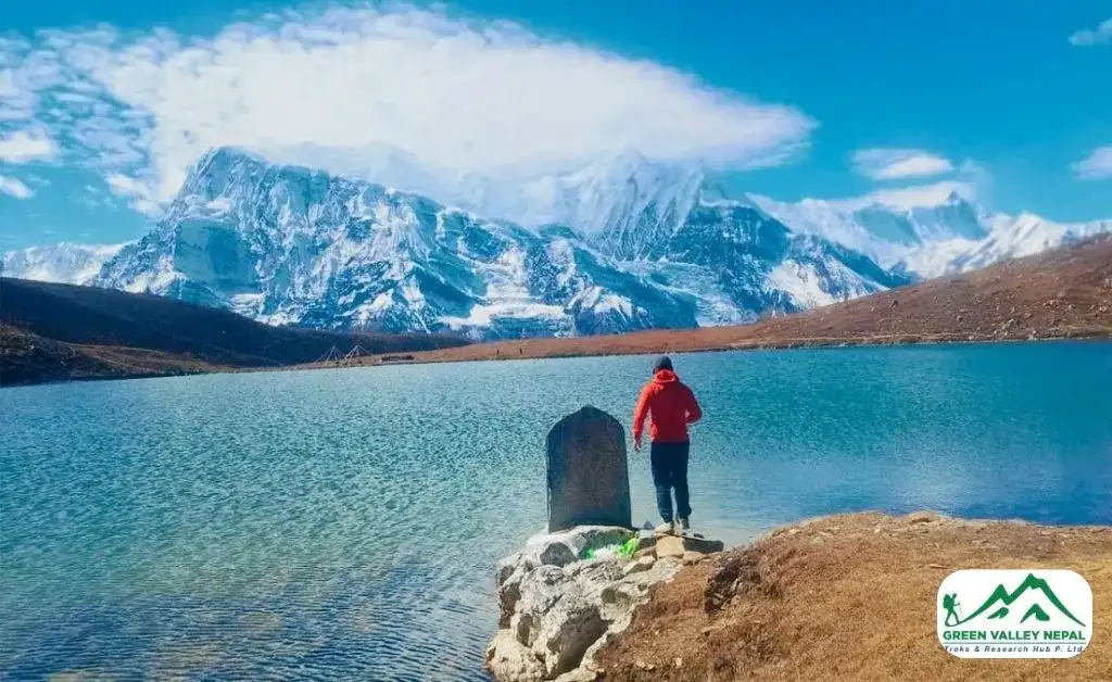
The circuit itself is already one of the longest treks in Nepal, but several popular diversions extend the total distance further. Most experienced trekkers say they're worth every extra step.
- Tilicho Lake (+12–15 km return): The Annapurna Tilicho Lake Trek adds a visit to one of the highest lakes in the world, sitting at 4,919 meters. The out-and-back from Shree Kharka takes 5–6 hours; budget at least 2 extra days if you're adding it.
- Poon Hill (+8 km): The early morning hike to Poon Hill (3,210m) from Ghorepani adds about 4 km each way. The sunrise view of the Annapurna range from here is one of the most photographed moments in Nepal trekking, and almost everyone includes it.
- Ice Lake near Manang (+10 km): A short but steep acclimatization hike up to the Ice Lake (4,600m), highly recommended for helping your body adjust before the higher stages of the trek.
- Bigger extensions: If you have more time, some trekkers link the circuit to the Annapurna Base Camp trek, the Nar Phu Valley, or Upper Mustang, each adding anywhere from 30 to over 100 km and several extra days. Some go further still and combine it with the Manaslu Circuit on our Manaslu Annapurna Circuit Trek, crossing two 5,000m+ passes: Larkya La and Thorong La, in one journey. These extensions are worth discussing directly with your trekking operator, since they require separate permits and a longer overall itinerary.
How Many Kilometers Do You Walk Per Day on the Annapurna Circuit?
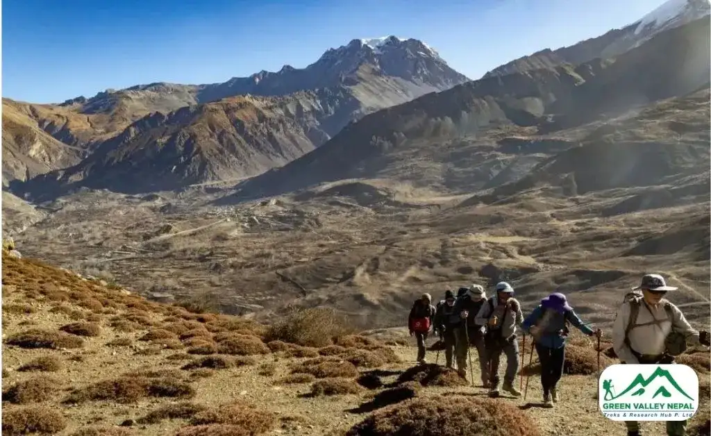
On most days, trekkers cover between 6 and 16 km. On average, that works out to 10–15 km per day, taking 5–7 hours of walking including rest stops.
- Easy days (near the start or end): 6–8 km, 3–4 hours
- Moderate days (mid-circuit): 10–14 km, 5–6 hours
- Hard days (high altitude): 6–12 km but 6–9 hours, due to thin air and steep terrain
- Thorong La Pass crossing: 10–16 km on paper, 7–9 hours in reality
The key thing to remember: distance on paper and distance in your body feel very different above 4,000 meters. You will move slower than you expect up there, and that's completely normal.
Total Elevation Gain: The Number That Matters as Much as Distance
Kilometers only tell half the story. From the trek's low point near Besisahar (roughly 800m) up to Thorong La Pass (5,416m), you gain a net elevation of around 4,600 meters. Because the trail constantly climbs and drops through side valleys and villages along the way rather than rising in a straight line, the true cumulative ascent, adding up every up-and-down, not just the net gain, runs somewhat higher than that net figure.
That's why two treks with an identical "190 km" distance can feel completely different depending on the itinerary: a route with more short, steep climbing days will feel harder than one with longer but gentler stretches, even at the same total kilometers.
Annapurna Circuit vs Everest Base Camp: Distance Compared
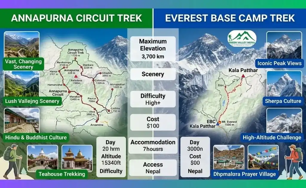
A common comparison question: the Annapurna Circuit covers significantly more ground than Everest Base Camp. The Annapurna Circuit runs up to 230 km against EBC's roughly 130 km, and takes you through far more varied terrain, subtropical valleys, high desert, and a 5,416m pass, compared to EBC's single up-and-back route to 5,364m.
EBC is more intense in its final approach; the Annapurna Circuit is more demanding overall in terms of total distance and trek duration. For the full picture beyond distance: cost, difficulty, scenery, and teahouse comfort, see our dedicated Everest Base Camp Trek vs Annapurna Circuit Trek comparison.
Final Thoughts
The Annapurna Circuit's distance isn't just a number on a map. It's terraced fields and prayer flags, the thin air at Thorong La Pass, yak bells echoing through Manang, a hot bowl of dal bhat after a long day's walk, and a sky full of stars at 4,000 meters.
Whether you walk 160 km or the full 230 km, what you carry home isn't the step count; it's the memory of having done something genuinely big in one of the most beautiful places on Earth. Take your time, prepare well, and respect the mountain. The distance will take care of itself.
If you are planning to trek the Annapurna Circuit and want experienced local guides, our team at Green Valley Nepal Treks can help you organize the entire journey, permits, transportation, accommodation, and experienced mountain guides.
Contact us today to start planning your Annapurna Circuit adventure.
Frequently Asked Questions (FAQs)
- How long does it take to trek the Annapurna Circuit?
It depends on your route and pace. The classic full circuit takes around 15 to 18 days. Starting from Chame or Dharapani by jeep and skipping the lower road sections lets you finish in 12 to 14 days. A short version focused only on the high-altitude stretch is doable in 10 to 12 days. Most guides recommend not rushing it, the mountain rewards those who slow down.
- Can you do the Annapurna Circuit in 10 days?
Yes, but you will need to compromise. In 10 days, you skip the lower sections by driving to Chame or Manang and focus on the high-altitude part: Thorong La Pass, Muktinath, and the descent. You will still cover around 80–100 km of real trail. It's possible, but not ideal for first-timers at high altitude, since proper acclimatization needs time and rushing increases the risk of altitude sickness.
- How far is Besisahar from Kathmandu, and does that count toward the trek distance?
Besisahar is roughly 175–195 km from Kathmandu by road, about 6–7 hours of driving. This driving distance is separate from your trekking distance; it gets you to the trailhead, but it's not part of the 160–230 km you actually walk.
- What is the elevation gain on the Annapurna Circuit, and does it matter more than distance?
The net elevation gain from Besisahar (around 800m) to Thorong La Pass (5,416m) is roughly 4,600 meters, with additional cumulative ascent from the trail's many ups and downs along the way. In practice, elevation gain and altitude affect your daily effort more than raw kilometers do; a short, steep, high-altitude day can be far harder than a longer day at lower elevation.
- Can a beginner do the Annapurna Circuit trek?
Yes, and many do. You don't need mountaineering experience or elite fitness, just a reasonable level of fitness, a good guide, and the patience to acclimatize properly in Manang. The daily walking distance of 10–15 km is manageable if you train with regular hikes in the months before. Altitude is the real challenge, not the distance itself.
- How fit do I need to be for the Annapurna Circuit?
You don't need to be an athlete, but you should be comfortable walking 5–7 hours a day for multiple days in a row. Start training at least 6–8 weeks before your trek with regular walks, light jogging, and stair climbing. The Thorong La Pass day is the hardest, around 10–16 km, but at 5,416 meters, so cardio matters more than raw muscle strength up there.
Is the Annapurna Circuit still worth it despite the new roads?
Absolutely. Road construction has indeed changed the lower sections of the trail. But everything above Manang is still completely raw, quiet, and breathtaking: the high-altitude desert around Manang, the Thorong La Pass crossing, Muktinath, and the Poon Hill sunrise are untouched. Most trekkers who finish say it exceeded their expectations. The road just means you drive through the dull bits and walk the magic bits.
- Which is harder, the Annapurna Circuit or Everest Base Camp?
Both are moderate-to-hard treks, but in different ways. Everest Base Camp sits at 5,364 meters, and its final approach is more dramatic in terms of altitude. The Annapurna Circuit covers significantly more distance: up to 230 km compared to EBC's roughly 130 km, through far more varied terrain over more days. EBC is more intense at the end; the Annapurna Circuit is more demanding overall in terms of distance and duration.
Have more questions about trekking in Nepal? Browse our full Nepal Trekking FAQs page.